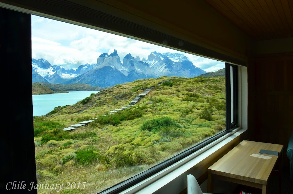
All Pictures are at the bottom on the post!
What happens when you take 13 people from all different backgrounds, PhD's (yes 3 and 7/8's have PhD's), folks with several graduate degrees, and a few of us dummies with just a simple college degree, all thirteen linked by one common trait, we all like running?
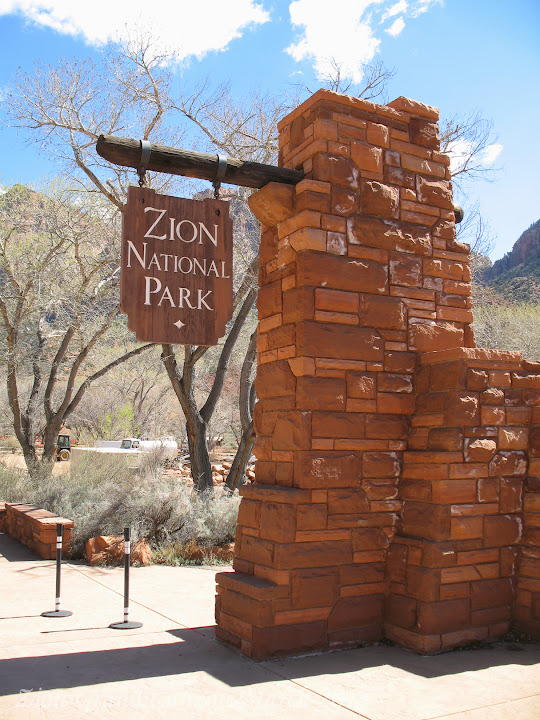
You have a great time. It all started last November when I saw an ad for the Zion Half Marathon. There were two things that intrigued me, team competition, and the location, Zion National Park.
I sent an email to the running group I belong to, "The Full Moon Running Club". I wanted to see if there was interest. The response was over whelming. As we planned the trip the number of participants was reduced as some members that wanted to join us had other obligations.

We did get 13 commitments, 10 runners and 3 supporters, also known as athletic supporters!
Lovely Lou Fancher also known as Lorenzo Laine Dug Margarite Dan The Man Mrs. Beasley Scott Merkel Sarah "T.C. Elliott" Gary Nolan Aims Naomi Dan K David Wolcott
While many of the runners and athletic supporters are from the Philadelphia, PA area, Dan The Man and Mrs. Beasley are from the greater Washington D.C. area and Naomi the 7/8's of a PhD is from Palo Alto, California, yes the shabby school of Stanford.
Coordinating travel was a bit tricky. Everybody was flying into Las Vegas and then driving to Saint George Utah, where we rented a house for the long weekend. We have the house checking in Thursday March 12th, checking out Monday March 16th. The race is Saturday with packet pick up on Friday.
Lovely Lou Fancher also known as Lorenzo offered to drive David Wolcott, Margarite, and I to the airport, we were all on the same flight along with Gary Noland, Aims, Sarah "T.C. Elliott" and Scott Merkel.
You know a trip is going to be great when it starts off on the right foot. We leave for the airport with plenty of time to catch our flight, plenty of time that is if they don't close down the highway. Yes,
 total standstill with an hour until departure. No fear Lovely Lou Fancher also known as Lorenzo is here. With emergency flashers on, down the emergency lane he goes, surface roads should be no problem we are about 30 minutes from the airport and we have an hour before our departure.
That is until we see a truck being unloaded and a fork lift blocking the road. What road Lovely Lou Fancher also known as Lorenzo says, as he hops the curb and drives down the sidewalk for a block or so. Clear sailing from here, NOT! The biggest fire truck you have ever seen, a hook and ladder on steroids, pulls out in front of us and just stops. Not deterred Lovely Lou Fancher also known as Lorenzo again hops the curb, cuts through the parking lot and goes head-on into on coming traffic.
We now have 30 minutes until our flight and we are about to have a head on collision with a semi, up on the sidewalk we go, finally back on the highway past the closure, should be clear sailing to the airport. We have about 15 minutes until departure and we have about 15 minutes to go. We call Aims and tell her, no matter what! HOLD the plane! Lovely Lou Fancher also known as Lorenzo makes the ultimate sacrifice, he drops us off at the door before parking the car. The three of us go running to our gate, Margarite and I do not need to go through security so we just run, David Wolcott does the full stripe search for TSA. We get to the gate as they are closing the door, Margarite heads to the ladies room, I beg for them to open the door, they agree and hand me two boarding passes.
Then they realize Margarite is not with me, she is actually hiding, keeping a lookout for David Wolcott, as she sees David Wolcott round the corner she appears and the three of us board, with no time to spare.
Lovely Lou Fancher also known as Lorenzo, still back parking his car. We would later find out he flew out a few hours later with Laine. Like I said you can always tell how a trip will be based on the
 start. Exciting, fun, thrilling, are all words that can be used to describe the drive to the airport.
We were the first to arrive at the house, and did the food shopping for the weekend.
Throughout the afternoon and evening more of the team arrive. Aims, Gary Nolan, Dan The Man, and Mrs. Beasley spent the night in Las Vegas and joined us Friday morning.
Friday -
Lots of things to do, Saint George is about 40 minutes from Zion National Park. Some of the group are hiking the Narrows, more on that later, some are doing other hikes, Aims, Gary Nolan, Dan The Man, Mrs. Beasley, Margarite, and I are doing a jeep tour.
First we had to pick up our race bibs and figure out the logistics for the race. The race is point to
 point starting a little over 13 miles from the park entrance. We found out we can be dropped at the start and our athletic supporters can then drive to the finish line. This will make things much easier in the morning.
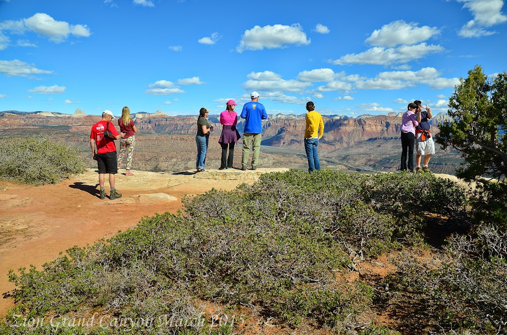
The jeep ride was a perfect excursion the day before a race. We climbed 2,000 feet up to the Mesa over looking Zion Canyon, we then drove the rim of the Mesa until descending back down a few miles and a few hours later. The tour was
 enjoyable and educational learning how old the different layers of the canyon are as well as how the Grand Canyon, Zion Canyon, and Bryce Canyon are related and how they all represent different layers (ages) of the earth.
After the tour the group all met back at the house for a pre-race pasta dinner and great stories of the day's activities.
Race Day - Zion Half Marathon.
The race start was scheduled for 7:30 AM. The course was 13.1 miles, point to point. The finish line
 was 200 meters form the entrance to Zion National Park, that put the start 13.1 miles plus 200 meters from the entrance. Our athletic supports dropped us off at the start. Scott and Sarah "T.C. Elliott" left their car at the start. They were concerned about their race times and wanted some flexibility for themselves and did not want to hold the rest of the team up after the finish.
The start was well organized, the temperature was 43 degrees, low humidity, actually very dry, skies as clear as could be, the black sky was overwhelmed with bright stars. There was a heating tent, which was a great place to hangout until the start. We arrived at the start at 6:30, we had an hour to kill.
Everybody has a different pre-race warm up, some stretch, some run a little, me, I just stand around. Fifteen minutes before the start the race director started ushering everyone out of the tent to the start. The race was full at 2,500 runners a relatively small race, but much larger than the first Zion Half
 Marathon just three years earlier which had 500 runners.
With the race running along an active roadway, the race director was concerned about spreading the runners out quickly, rather than have them bunched up on the road way. To accomplish this, the start went through a very narrow corral.
Funneling 2,500 runners through a narrow corral was a great way to insure a safe race, but also caused a very slow start. Our team was spread throughout the start. Dan the Man and Margarite just inches off the starting line. David Wolcott and Gary Nolan several hundred runners behind them, Lovely Lou Fancher also known as Lorenzo , Laine and I were next about 1,000 runners back, Naomi, Sarah "T.C. Elliott", and Scott behind us.

Lovely Lou Fancher also known as Lorenzo , developed a perfect strategy for this race based on our training (very little), the altitude (about 5,000 feet), and hills we would encounter. The strategy - start off in the middle of the pack, take it easy for the first 3 miles maintains a 9 minutes mile pace, stay relaxed and see how our bodies react to the altitude and hills, after mile 3 depending how we felt turn it up or down a notch.
Mile one - 8:58.9 elevation gain 69 feet very mild up hill Mile two - 8:53.2 elevation gain 71 feet loss 49 feet, some rolling hills Mile three - 8:52.7 elevation gain 17 feet loss 28 feet, relatively flat.
At this point in the race Naomi had passed us, David Wolcott and Gary Nolan were ahead of us, Dan the Man and Margarite were no where to be seen. We felt good and decided to turn it up a notch, a small notch we still had ten miles to go and our training had been weak at best.
Mile four - 8:45.4 elevation gain 100 feet loss 58 feet, still rolling hills, but getting steeper.
Mile five - 8:42.8 elevation gain 31 feet loss 50 feet, back to a smaller hills
Mile six - 8:50.1 elevation gain 93 feet loss 68 feet, the hills were growing, but with our proper warm
 up they were not bothering us.
Mile seven - 8:55.8 elevation gain 165 feet loss 0 feet, this was our first challenging hill and the three of us felt great. David Wolcott was now running with us and we could see Gary Nolan up ahead. It was time to turn on the gas.
Mile eight - 8:17.8 elevation gain 0 feet loss 80 feet, we picked the perfect place to turn on the gas a nice down hill
Mile nine 7:53.5 elevation gain 52 feet loss 0 feet, somewhat flat we now lost David Wolcott and had past Gary Nolan, we all felt strong.
Mile ten 7:53.9 elevation gain 79 feet loss 57 feet, another rolling hill up and then down. Lovely Lou Fancher also known as Lorenzo was pulling ahead of me he did a 7:40 flat.
Mile eleven 8:12.8 elevation gain 109 feet loss 93 feet, we go up hill and then give it all back. Lovely Lou Fancher also known as Lorenzo is pulling further ahead I can still see him but he did mile 11 in 7:59
Mile twelve 8:24.0 elevation gain 110 feet loss 46 feet we passed Naomi, for the team score, Lovely Lou Fancher also known as Lorenzo is in third, I am in fourth and Naomi is our fifth runner. Lovely Lou Fancher also known as Lorenzo ran an 8:08 it appears he has more gas than me.
Mile thirteen 8:03.2 elevation gain 99 feet loss 35 feet, we can see the finish line Lovely Lou Fancher also known as Lorenzo ran at 7:52
The last .10 was really .2 at least according to our GPS. Lovely Lou Fancher also known as Lorenzo beat me by a full minute EXACTLY 1:51.22 for Lovely Lou Fancher also known as Lorenzo and 1:52.22 for DUG.

Margarite finished first for our team, winning the women's masters division and the 10th overall
women. Dan the Man finished second for our team getting third in his age group. Next, Lovely Lou Fancher also known as Lorenzo third on our team 7th in his age group, I was a minute behind Lovely Lou Fancher also known as Lorenzo and 8th in my age group. Naomi was our fifth place team member. Here are the entire teams stats.
Margarite Time 1:38:42 Pace 7:32 Place 1
Dan the Man M Time1:41:24 Pace 7:44 Place 3
Lovely Lou Fancher also known as Lorenzo M Time 1:51:19 Pace 8:30 Place 7
Dug M Time 1:52:19 Pace 8:34 Place 8
Naomi Time 1:53:03 Pace 8:38 Place 12
Laine Time 1:54:12 Pace 8:43 Place 7
Gary Nolan Time 1:54:45 Pace 8:46 Place 15
David Wolcott Time 1:56:06 Pace 8:52 Place 17
Scott Time 2:41:30 Pace 12:20 Place 542
Sarah "T.C. Elliott" Time 2:41:30 Pace 12:20 Place 797
As I had mentioned earlier this race had a team category, there were 76 teams, we assumed we did not place based on our age and that most of us were not all out racing the course.
 After Margarite and Dan the Man received there awards, we had changed our clothes and were getting ready for the afternoon hike. All of a sudden we heard, "the third place team, the full moon running club". Yep we got third place. We were all very excited about placing third.
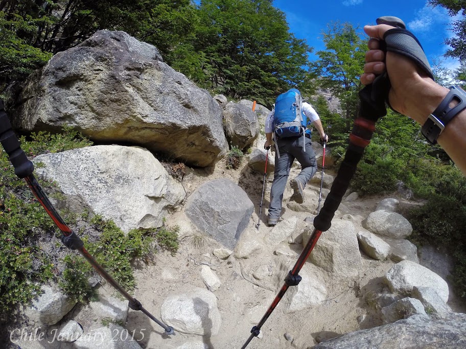
Our plan after the race was to hike Angels Landing. The Zion Half Marathon has an additional challenge, beside just the race, if you hike Angles landing within 72 hours of the finish you get profiled on their web site and get a reduced rate at next years race. Our plan, do the hike immediately following the race.
Great news for getting first place in the masters division, Margarite won a years pass for all national parks.
We were not sure where Sarah "T.C. Elliott" and Scott were, the plan was not to wait and just head to Angels Landing. We were off, the 9 of us. Dan the Man, Mrs. Beasley, Lovely Lou Fancher also known as Lorenzo , Laine, David Wolcott, Margarite, Gary Nolan, Aims Dan K and I. What about Naomi, you might ask? Running a half marathon was not enough for her, she was doing another 13.1 miles to get a full marathon in. Can you say CRAZY?
The trail head for Angels Landing was 5 miles from the park entrance a few hundred meters from the
 Zion Park Lodge. Angels landing starts out very deceiving, it starts out as a paved path like a sidewalk with barley and incline. That last for a few hundred meters, then the trail quickly changes from a flat trail to one with an incline that ranges from 15 - 20%. Yes, rather steep, the great news everybody's legs were feeling great. The trail runs along a shear cliff wall, with the trail just over two feet wide, besides the incline the hike was relatively simple. That was all about to change. The hike was billed as a 5 mile hike, 2.5 miles each way.
When we reached the 2 mile mark there was plateau, this area was rather crowded. Lovely Lou Fancher also known as Lorenzo , Laine, Dan the Man, Dan K, Mrs. Beasley, and David Wolcott had gotten ahead of Margarite, Gary Nolan and I. Aims was having some knee pain and had turned back.
We ran into Dan K he had decided not to continue to Angels Landing. He was going to do the Rim Trail. We told him we would meet up at the trail head at 3:30 PM.
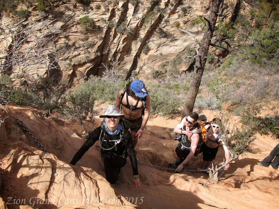 As we continued to the Landing we came to what can only be described as a shear cliff with a few out crops along the wall, with chains bolted into the rock. Along this wall you could find 5 to 8 inch foot holds. The next leg of the hike would be along this wall. In all actuality it looked a lot worse than it would be if it was one way traffic. Since it was two way traffic it was actually a lot worse then it looked. Gary Nolan and I continued on the hike, Margarite decided to wait at this point where she ran into David Wolcott.
Gary Nolan and I proceeded up this section of the hike at first with no regrets, then we ran into on coming traffic. It was as bad as any major traffic jam I had ever been in. True grid lock. No way up for us or for the on coming traffic to go down. After what seemed like 10 minutes, but was more likely 10 seconds a women started directing traffic, better than the best street cop. You move 5 inches this way, you crawl 1 foot that way, you back up 2 inches, etc... After a few minutes of these small maneuvers she had cleared the trail, we were on our way again.
My guess is after about 50 meters maybe 20 minutes we came to a landing. I thought wow, we are here! NO! I looked out and saw what could only be described as a very narrow stairway to heaven.
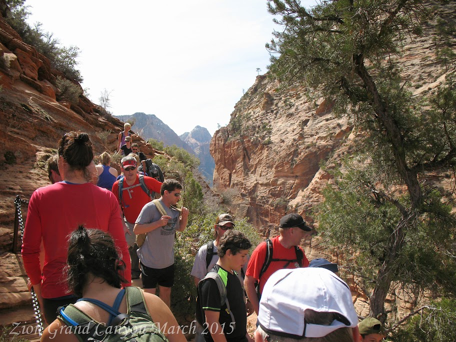 With 2,000 foot drops on either side.
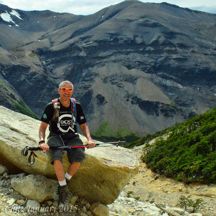
I had, had enough, the old saying, "the first 40 years you try to kill yourself, and the second 40 years you try to stay alive" could not have been anymore true for me in this decision to head back. Gary Nolan, either braver or dumber than me, decided to continue on.
I met back up with Margarite and David Wolcott, where we waited for the others to return down from Angels Landing. While we waited we hoped that no one in our group would be one of the few hikers that die hiking Angels Landing each year.
Once our group return we hiked back the 2 miles to meet up with Aims at the trail head. We assumed we would either catch up with Dan K or find him at the trail head. Aims was waiting as expected, but no Dan K. We waited about 15 minutes, there was no cell service so we were at a loss as to where he could be.
A few in the group left to get to a cell service area and check to see if Naomi had heard from Dan K. She had not!
 We waited a little over an hour, we replayed every possible scenario:
Could he be lost?
Could he be hurt?
Could he of gotten done early, and headed back?
Did he fall asleep somewhere?
We waited a little over an hour, we replayed every possible scenario:
Could he be lost?
Could he be hurt?
Could he of gotten done early, and headed back?
Did he fall asleep somewhere?
As the time ticked on, we stuck to our team motto, "never leave a man behind". As we approached 5:00 PM now well over an hour after our original meeting time we walked down to the lodge, there were two goals, use our cell phones to check with the rest of the group (there was cell service at the lodge), and to get the car and bring it back to the meeting area. Lovely Lou Fancher also known as Lorenzo and I decided we would change into our running shoes, grab a few bottles of water and run the trail looking for Dan K. Just what we wanted to be doing.
As we pulled back to the trail head there was Dan K sitting on the park bench just hanging out. Long story short, Dan K thought the meeting time was closer to 5:00 and not 3:30.
All was fine once Dan K splurged for the evenings beer cost.
Once everybody was back at the house we had a great celebration barbecue. Dan the Man made his famous margarita's, what a great way to end a great day.
Sunday - today would be the majority of the groups last day at Zion. Several of us decided to do the
 Narrows hike. There is no real way to describe this hike that allows you to get a feel for what it is all about. But I will try.
Think of a canyon with both sides made up of shear walls two thousand feet tall. The bottom of the canyon is sand, and rocks, all of this covered with a slow moving River ranging from just a few inches deep to well over 12 feet deep. The water temperature around 40 degrees.
I have to say one of the most unique hikes I have ever done. Fortunately Lovely Lou Fancher also known as Lorenzo did some research and found a place that rented dry suits and water hiking boats. A few of us opted for just dry pants vs. the full suit. It actually was not a choice the guide shop ran out of full suits.

For us folks in pants we had to be careful and make sure we did not go deeper in the river then our wastes. Also we could not float back down stream, like the full suit folks.
Aims took a nice tumble trying to cross over some rapids rather than crossing at a little shallower wider section. Great for the video (about 12 minutes in) a little scary for Aims.

Dinner was left over's and some great talk.
Leaving Zion - check out of our house is 11:00 so it was time to hit the road.
Everybody was going their own which way. Margarite and I were heading to the Grand Canyon. It was several hours from Zion to the Grand Canyon. We decided to break up the ride by stopping at Page, Arizona and visiting Antelope Canyon, on the Navajo reservation. You can only tour this canyon with a tour guide. I highly recommend Irene and she is with Antelope Slot Canyon Tours. Not
 only is Irene very knowledgeable about the canyon, she is an expert photographer and loves to pass on her photography skills.
The section of Antelope Canyon that we toured is called the upper slot canyon. The entrance is a narrow slot maybe 30 feet wide. As you enter you realize this is actually the widest part of the canyon it narrows in some places to as little as a few feet.
With the sun over head, and just a narrow slot for the sun rays to come in, the colors were magnificent.
After the tour we continued on to the Grand Canyon. We had booked rooms at the Yavapai Lodge.
The plan was get a good nights sleep and then hike to the bottom of the Grand Canyon. This is a hike I had done 35 years before when on a motorcycle trip across North America.
 Sunrise was at 6:30 AM and Sunset was at 6:30 PM this gave us a 12 hour window to do the hike in daylight. We decided not to set the alarm and to just wake up when our bodies said wake up. We felt being well rested was more important than day light.
We ended up hitting the trail head at 8:00 AM. This gave us 10.5 hours of day light, this should be fine for our planned hike. Thirty five years ago, I took three days to hike to the bottom and back out. We hiked the Bright Angel trail spending the first night at the Indian Gardens Camp ground which is half way to the bottom. The second day we hike to the bottom and spent the night camping at the bottom. The last day we hiked up the South Kaibab Trail total distance 16 miles, total elevation loss 6,000 feet (over 1 mile) total gain 6,000 feet (over 1 mile).
Today our plan is to hike the Bright Angel trail to the river 7.5 miles and return the same way. Total 15 miles. Like I said that was our plan.
Being March there was still some snow on the trail, the temperature was 45 degrees but warming fast.Rob Jones was the Grand Penultimate Poobah - Service Projects for the Grand Canyon. He explained that for us to get the best experience out of our hike we needed to go all the way to Phantom Ranch, and then return via the South Kaibab Trail.
 The colors were fantastic. The plant life was great and hardy, some of the plants even flowering. We were about a mile into the hike when we ran into another couple. They were hiking to Indian Gardens to spend a week there. They had volunteered to help with some spring maintenance. It ended up the husband
This idea was a little daunting, this was the same route I had done 35 years prior when I was 19, and I took three days. Now at 54 just a few days off a half marathon it was being suggested we do the same hike in under 10 hours. As we continued on, Rob Jones's departing words were, "Make sure you have head lamps, and plenty of food and water!".
We were prepared from the stand point of supplies the bigger question could our bodies handle the hike. We took a quick pit stop at Indian Gardens topped our water supplies and ate a snack. We were
 5 miles into the hike and just 2.5 miles from the river. Bright Angel Trail starts out steep but quickly turns into a gently downhill hike. As we continued down we met many hikers coming up that had spent the night at the bottom. Some were just hiking to Indian Gardens to spend the night, others were going all the way up to the rim.
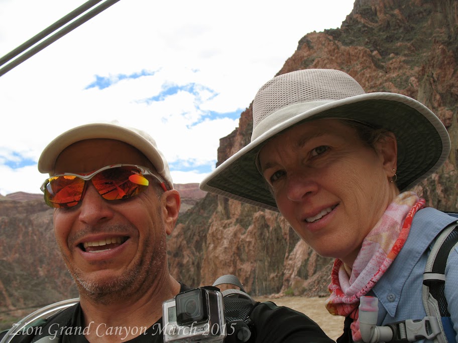
We reached the river and felt great, it was decision time. Do we continue up river to Phantom Ranch, another 2.5 miles? We felt good so we continued on! Our pace was over 2 miles and hour close to 3. This makes sense up to this point we had been going down hill. As we continued I remembered the hike to Phantom Ranch was not flat along the river. You actually have to hike back up the canyon wall before being able to follow the river up stream to the ranch. We crossed the river at the Silver Bridge finally making it to Phantom Ranch just before noon. We met a few other hikers doing the hike in one day, but they were doing the hike in the opposite direction. Steep on the way down not so steep on the way up.
We had a nice lunch, again we topped off our water. There would be no drinking water on the South Kaibab Trail. We headed toward the Black Bridge which was the start of the Kaibab Trail. We had
 covered 10 miles in just over 4 hours. We were not 100 % positive about the distance from the Black Bridge to the rim, but thought it to be 6 miles.
The elevation we would be gaining was greater than the elevation we had lost. Yes, the rim at the South Kaibab Trail was higher than the rim at the Bright Angel Trail. The other big difference, we would be doing it in 6 miles rather than 7.5 miles on the way down. Plus we would be going up rather than going down. Next time you go up or down stairs try to feel what the difference in exertion going up vs. going down. We had 6.5 hours of day light left. Our goal, slow and steady. Do not over exert ourselves, make sure we eat and drink. Everything was going fine. At mile 2, of the accent, mile twelve of the hike, Margarite started feeling nauseous. She had been eating and drinking properly. It was warm out, about 75 degrees. I am sure after 12 miles, five or so hours of hiking we had sweated out a good bit of salt. Margarite took two salt tablets and I took one.
That was the issue Margarite slowly began to feel better and we continued on. There was one section
 of the trail called Jacobs ladder. This is an endless staircase where you climb endlessly toward the rim of the canyon. With two miles to go the trail got more and more populated. The hikers we were running into were folks that were only hiking short distances into the canyon and then turning back up toward the rim.
We must of looked fairly bad, as some of the comments, "wow, how far down did you go?", "it must be a lot harder to come up then to go down!"
We reached the rim just after 4:00 PM a little over 8 hours in time and a little over 16 miles in distance and over 6,000 feet in elevation loss and gain. The same hike I had done 35 years prior I did about 60 hours quicker, not that it was a race.
We had a nice dinner at the Bright Angel Lodge and then hit the sack with a great feeling of accomplishment. Oh, and did I mention all the signs we passed telling people not to hike to the bottom in one day!
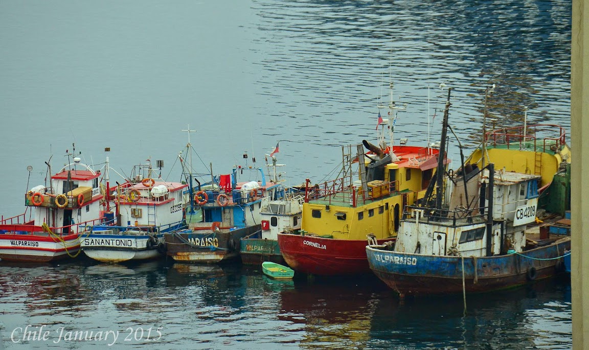
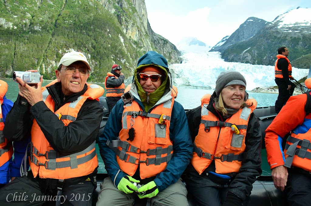
Off to Canyon Ranch - What a world win tour we are on, next stop Tucson Arizona and Canyon Ranch. We visit our friend Chephart Yosh every year in Tucson and this year is no exception. Usually we visit in January, since we were in Chile in January we moved our visit to March.
We had several hours of driving to get from the Grand Canyon to Tucson, we decided to break it up a bit. Our first stop was in Flagstaff, AZ where we had breakfast at MartAnne's. What a great meal. If you are in Flagstaff you must go here. After breakfast we visited Absolute Bikes. A great local bike shop that has both road bike and mountain bike rides you can join in on. Unfortunately we did not have our bikes with us, but we did buy a shirt.
After Flagstaff we drove through Sedona. What beautiful landscapes. We did not stop in the town as it seemed to touristy for us.
As we approached lunch time we stopped at Chelsea's Kitchen in Scottsdale and had lunch on there out side patio. The food and service was just perfect.
Next stop Tucson, we arrived around 4:00 PM caught up with Chephart Yosh and checked into the ranch.
We have limited time with Chephart Yosh so we are going to try to make the most of it. A few highlights. Canyon Ranch added an outdoor boot camp that was a great workout. We did that twice. They added more stretching classes, after our Grand Canyon hike we really took advantage of those.
 One new class that we had been wanting to try is surf set. It is a surf board mounted on three balls to make it unstable. You do the work out on the surf board. What a great core workout.
A quick story. We had been working out all day. We decided to do a fairly hard pool workout at the end of the day. I wear my jammers that I wear when I swim, a tight fitting swim suit. The workout consisted of doing suicides, high knee kicks, and many other cardio type of exercises all in four feet of water. A low impact, high resistant work out. Just what we needed.
After the work out Margarite and I laid on the lounge chairs to dry out. This rather portly women comes over and says, " I hope you do not mind, but I really think you should wrap a towel around your waist before you get up! " I thanked her as she walked away. I say to Margarite, that was strange my suit is not that revealing, maybe I should of told her she should lose 60 lbs before she puts a bathing suit on, but I held my tongue. A few minutes go by and we go to leave to take showers. There is no way I am wrapping a towel around my waist. As I get up, Margarite says you may want to rethink wrapping the towel around your waist. Apparently during the high kicks or tire throws, I ripped out the back seam of my swim suit and I truly proved I was a full fledged member of the Full Moon Running Club, my moon was shining for everyone to see.
The best part of the trip was Chephart Yosh had arranged for a tour of Kartchner Caverns State Park. Unfortunately, no cameras allowed so no pictures, but it was spectacular.
Now I am off to who knows where.
Cheers,
DUG
What happens when you take 13 people from all different backgrounds, PhD's (yes 3 and 7/8's have PhD's), folks with several graduate degrees, and a few of us dummies with just a simple college degree, all thirteen linked by one common trait, we all like running?
You have a great time. It all started last November when I saw an ad for the Zion Half Marathon. There were two things that intrigued me, team competition, and the location, Zion National Park.
I sent an email to the running group I belong to, "The Full Moon Running Club". I wanted to see if there was interest. The response was over whelming. As we planned the trip the number of participants was reduced as some members that wanted to join us had other obligations.
We did get 13 commitments, 10 runners and 3 supporters, also known as athletic supporters!
Lovely Lou Fancher also known as Lorenzo Laine Dug Margarite Dan The Man Mrs. Beasley Scott Merkel Sarah "T.C. Elliott" Gary Nolan Aims Naomi Dan K David Wolcott
While many of the runners and athletic supporters are from the Philadelphia, PA area, Dan The Man and Mrs. Beasley are from the greater Washington D.C. area and Naomi the 7/8's of a PhD is from Palo Alto, California, yes the shabby school of Stanford.
Coordinating travel was a bit tricky. Everybody was flying into Las Vegas and then driving to Saint George Utah, where we rented a house for the long weekend. We have the house checking in Thursday March 12th, checking out Monday March 16th. The race is Saturday with packet pick up on Friday.
Lovely Lou Fancher also known as Lorenzo offered to drive David Wolcott, Margarite, and I to the airport, we were all on the same flight along with Gary Noland, Aims, Sarah "T.C. Elliott" and Scott Merkel.
You know a trip is going to be great when it starts off on the right foot. We leave for the airport with plenty of time to catch our flight, plenty of time that is if they don't close down the highway. Yes,
That is until we see a truck being unloaded and a fork lift blocking the road. What road Lovely Lou Fancher also known as Lorenzo says, as he hops the curb and drives down the sidewalk for a block or so. Clear sailing from here, NOT! The biggest fire truck you have ever seen, a hook and ladder on steroids, pulls out in front of us and just stops. Not deterred Lovely Lou Fancher also known as Lorenzo again hops the curb, cuts through the parking lot and goes head-on into on coming traffic.
We now have 30 minutes until our flight and we are about to have a head on collision with a semi, up on the sidewalk we go, finally back on the highway past the closure, should be clear sailing to the airport. We have about 15 minutes until departure and we have about 15 minutes to go. We call Aims and tell her, no matter what! HOLD the plane! Lovely Lou Fancher also known as Lorenzo makes the ultimate sacrifice, he drops us off at the door before parking the car. The three of us go running to our gate, Margarite and I do not need to go through security so we just run, David Wolcott does the full stripe search for TSA. We get to the gate as they are closing the door, Margarite heads to the ladies room, I beg for them to open the door, they agree and hand me two boarding passes.
Then they realize Margarite is not with me, she is actually hiding, keeping a lookout for David Wolcott, as she sees David Wolcott round the corner she appears and the three of us board, with no time to spare.
Lovely Lou Fancher also known as Lorenzo, still back parking his car. We would later find out he flew out a few hours later with Laine. Like I said you can always tell how a trip will be based on the
We were the first to arrive at the house, and did the food shopping for the weekend.
Throughout the afternoon and evening more of the team arrive. Aims, Gary Nolan, Dan The Man, and Mrs. Beasley spent the night in Las Vegas and joined us Friday morning.
Friday -
Lots of things to do, Saint George is about 40 minutes from Zion National Park. Some of the group are hiking the Narrows, more on that later, some are doing other hikes, Aims, Gary Nolan, Dan The Man, Mrs. Beasley, Margarite, and I are doing a jeep tour.
First we had to pick up our race bibs and figure out the logistics for the race. The race is point to
The jeep ride was a perfect excursion the day before a race. We climbed 2,000 feet up to the Mesa over looking Zion Canyon, we then drove the rim of the Mesa until descending back down a few miles and a few hours later. The tour was
After the tour the group all met back at the house for a pre-race pasta dinner and great stories of the day's activities.
Race Day - Zion Half Marathon.
The race start was scheduled for 7:30 AM. The course was 13.1 miles, point to point. The finish line
The start was well organized, the temperature was 43 degrees, low humidity, actually very dry, skies as clear as could be, the black sky was overwhelmed with bright stars. There was a heating tent, which was a great place to hangout until the start. We arrived at the start at 6:30, we had an hour to kill.
Everybody has a different pre-race warm up, some stretch, some run a little, me, I just stand around. Fifteen minutes before the start the race director started ushering everyone out of the tent to the start. The race was full at 2,500 runners a relatively small race, but much larger than the first Zion Half
With the race running along an active roadway, the race director was concerned about spreading the runners out quickly, rather than have them bunched up on the road way. To accomplish this, the start went through a very narrow corral.
Funneling 2,500 runners through a narrow corral was a great way to insure a safe race, but also caused a very slow start. Our team was spread throughout the start. Dan the Man and Margarite just inches off the starting line. David Wolcott and Gary Nolan several hundred runners behind them, Lovely Lou Fancher also known as Lorenzo , Laine and I were next about 1,000 runners back, Naomi, Sarah "T.C. Elliott", and Scott behind us.
Lovely Lou Fancher also known as Lorenzo , developed a perfect strategy for this race based on our training (very little), the altitude (about 5,000 feet), and hills we would encounter. The strategy - start off in the middle of the pack, take it easy for the first 3 miles maintains a 9 minutes mile pace, stay relaxed and see how our bodies react to the altitude and hills, after mile 3 depending how we felt turn it up or down a notch.
Mile one - 8:58.9 elevation gain 69 feet very mild up hill Mile two - 8:53.2 elevation gain 71 feet loss 49 feet, some rolling hills Mile three - 8:52.7 elevation gain 17 feet loss 28 feet, relatively flat.
At this point in the race Naomi had passed us, David Wolcott and Gary Nolan were ahead of us, Dan the Man and Margarite were no where to be seen. We felt good and decided to turn it up a notch, a small notch we still had ten miles to go and our training had been weak at best.
Mile four - 8:45.4 elevation gain 100 feet loss 58 feet, still rolling hills, but getting steeper.
Mile five - 8:42.8 elevation gain 31 feet loss 50 feet, back to a smaller hills
Mile six - 8:50.1 elevation gain 93 feet loss 68 feet, the hills were growing, but with our proper warm
Mile seven - 8:55.8 elevation gain 165 feet loss 0 feet, this was our first challenging hill and the three of us felt great. David Wolcott was now running with us and we could see Gary Nolan up ahead. It was time to turn on the gas.
Mile eight - 8:17.8 elevation gain 0 feet loss 80 feet, we picked the perfect place to turn on the gas a nice down hill
Mile nine 7:53.5 elevation gain 52 feet loss 0 feet, somewhat flat we now lost David Wolcott and had past Gary Nolan, we all felt strong.
Mile ten 7:53.9 elevation gain 79 feet loss 57 feet, another rolling hill up and then down. Lovely Lou Fancher also known as Lorenzo was pulling ahead of me he did a 7:40 flat.
Mile eleven 8:12.8 elevation gain 109 feet loss 93 feet, we go up hill and then give it all back. Lovely Lou Fancher also known as Lorenzo is pulling further ahead I can still see him but he did mile 11 in 7:59
Mile twelve 8:24.0 elevation gain 110 feet loss 46 feet we passed Naomi, for the team score, Lovely Lou Fancher also known as Lorenzo is in third, I am in fourth and Naomi is our fifth runner. Lovely Lou Fancher also known as Lorenzo ran an 8:08 it appears he has more gas than me.
Mile thirteen 8:03.2 elevation gain 99 feet loss 35 feet, we can see the finish line Lovely Lou Fancher also known as Lorenzo ran at 7:52
The last .10 was really .2 at least according to our GPS. Lovely Lou Fancher also known as Lorenzo beat me by a full minute EXACTLY 1:51.22 for Lovely Lou Fancher also known as Lorenzo and 1:52.22 for DUG.
Margarite finished first for our team, winning the women's masters division and the 10th overall
women. Dan the Man finished second for our team getting third in his age group. Next, Lovely Lou Fancher also known as Lorenzo third on our team 7th in his age group, I was a minute behind Lovely Lou Fancher also known as Lorenzo and 8th in my age group. Naomi was our fifth place team member. Here are the entire teams stats.
Margarite Time 1:38:42 Pace 7:32 Place 1
Dan the Man M Time1:41:24 Pace 7:44 Place 3
Lovely Lou Fancher also known as Lorenzo M Time 1:51:19 Pace 8:30 Place 7
Dug M Time 1:52:19 Pace 8:34 Place 8
Naomi Time 1:53:03 Pace 8:38 Place 12
Laine Time 1:54:12 Pace 8:43 Place 7
Gary Nolan Time 1:54:45 Pace 8:46 Place 15
David Wolcott Time 1:56:06 Pace 8:52 Place 17
Scott Time 2:41:30 Pace 12:20 Place 542
Sarah "T.C. Elliott" Time 2:41:30 Pace 12:20 Place 797
As I had mentioned earlier this race had a team category, there were 76 teams, we assumed we did not place based on our age and that most of us were not all out racing the course.
Our plan after the race was to hike Angels Landing. The Zion Half Marathon has an additional challenge, beside just the race, if you hike Angles landing within 72 hours of the finish you get profiled on their web site and get a reduced rate at next years race. Our plan, do the hike immediately following the race.
Great news for getting first place in the masters division, Margarite won a years pass for all national parks.
We were not sure where Sarah "T.C. Elliott" and Scott were, the plan was not to wait and just head to Angels Landing. We were off, the 9 of us. Dan the Man, Mrs. Beasley, Lovely Lou Fancher also known as Lorenzo , Laine, David Wolcott, Margarite, Gary Nolan, Aims Dan K and I. What about Naomi, you might ask? Running a half marathon was not enough for her, she was doing another 13.1 miles to get a full marathon in. Can you say CRAZY?
The trail head for Angels Landing was 5 miles from the park entrance a few hundred meters from the
When we reached the 2 mile mark there was plateau, this area was rather crowded. Lovely Lou Fancher also known as Lorenzo , Laine, Dan the Man, Dan K, Mrs. Beasley, and David Wolcott had gotten ahead of Margarite, Gary Nolan and I. Aims was having some knee pain and had turned back.
We ran into Dan K he had decided not to continue to Angels Landing. He was going to do the Rim Trail. We told him we would meet up at the trail head at 3:30 PM.
Gary Nolan and I proceeded up this section of the hike at first with no regrets, then we ran into on coming traffic. It was as bad as any major traffic jam I had ever been in. True grid lock. No way up for us or for the on coming traffic to go down. After what seemed like 10 minutes, but was more likely 10 seconds a women started directing traffic, better than the best street cop. You move 5 inches this way, you crawl 1 foot that way, you back up 2 inches, etc... After a few minutes of these small maneuvers she had cleared the trail, we were on our way again.
My guess is after about 50 meters maybe 20 minutes we came to a landing. I thought wow, we are here! NO! I looked out and saw what could only be described as a very narrow stairway to heaven.
I had, had enough, the old saying, "the first 40 years you try to kill yourself, and the second 40 years you try to stay alive" could not have been anymore true for me in this decision to head back. Gary Nolan, either braver or dumber than me, decided to continue on.
I met back up with Margarite and David Wolcott, where we waited for the others to return down from Angels Landing. While we waited we hoped that no one in our group would be one of the few hikers that die hiking Angels Landing each year.
Once our group return we hiked back the 2 miles to meet up with Aims at the trail head. We assumed we would either catch up with Dan K or find him at the trail head. Aims was waiting as expected, but no Dan K. We waited about 15 minutes, there was no cell service so we were at a loss as to where he could be.
A few in the group left to get to a cell service area and check to see if Naomi had heard from Dan K. She had not!
As the time ticked on, we stuck to our team motto, "never leave a man behind". As we approached 5:00 PM now well over an hour after our original meeting time we walked down to the lodge, there were two goals, use our cell phones to check with the rest of the group (there was cell service at the lodge), and to get the car and bring it back to the meeting area. Lovely Lou Fancher also known as Lorenzo and I decided we would change into our running shoes, grab a few bottles of water and run the trail looking for Dan K. Just what we wanted to be doing.
As we pulled back to the trail head there was Dan K sitting on the park bench just hanging out. Long story short, Dan K thought the meeting time was closer to 5:00 and not 3:30.
All was fine once Dan K splurged for the evenings beer cost.
Once everybody was back at the house we had a great celebration barbecue. Dan the Man made his famous margarita's, what a great way to end a great day.
Sunday - today would be the majority of the groups last day at Zion. Several of us decided to do the
Think of a canyon with both sides made up of shear walls two thousand feet tall. The bottom of the canyon is sand, and rocks, all of this covered with a slow moving River ranging from just a few inches deep to well over 12 feet deep. The water temperature around 40 degrees.
I have to say one of the most unique hikes I have ever done. Fortunately Lovely Lou Fancher also known as Lorenzo did some research and found a place that rented dry suits and water hiking boats. A few of us opted for just dry pants vs. the full suit. It actually was not a choice the guide shop ran out of full suits.
For us folks in pants we had to be careful and make sure we did not go deeper in the river then our wastes. Also we could not float back down stream, like the full suit folks.
Aims took a nice tumble trying to cross over some rapids rather than crossing at a little shallower wider section. Great for the video (about 12 minutes in) a little scary for Aims.
Dinner was left over's and some great talk.
Leaving Zion - check out of our house is 11:00 so it was time to hit the road.
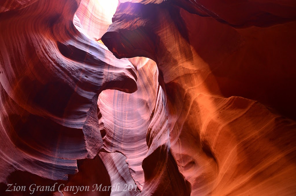
Everybody was going their own which way. Margarite and I were heading to the Grand Canyon. It was several hours from Zion to the Grand Canyon. We decided to break up the ride by stopping at Page, Arizona and visiting Antelope Canyon, on the Navajo reservation. You can only tour this canyon with a tour guide. I highly recommend Irene and she is with Antelope Slot Canyon Tours. Not
The section of Antelope Canyon that we toured is called the upper slot canyon. The entrance is a narrow slot maybe 30 feet wide. As you enter you realize this is actually the widest part of the canyon it narrows in some places to as little as a few feet.
With the sun over head, and just a narrow slot for the sun rays to come in, the colors were magnificent.
After the tour we continued on to the Grand Canyon. We had booked rooms at the Yavapai Lodge.
The plan was get a good nights sleep and then hike to the bottom of the Grand Canyon. This is a hike I had done 35 years before when on a motorcycle trip across North America.
We ended up hitting the trail head at 8:00 AM. This gave us 10.5 hours of day light, this should be fine for our planned hike. Thirty five years ago, I took three days to hike to the bottom and back out. We hiked the Bright Angel trail spending the first night at the Indian Gardens Camp ground which is half way to the bottom. The second day we hike to the bottom and spent the night camping at the bottom. The last day we hiked up the South Kaibab Trail total distance 16 miles, total elevation loss 6,000 feet (over 1 mile) total gain 6,000 feet (over 1 mile).
Today our plan is to hike the Bright Angel trail to the river 7.5 miles and return the same way. Total 15 miles. Like I said that was our plan.
Being March there was still some snow on the trail, the temperature was 45 degrees but warming fast.Rob Jones was the Grand Penultimate Poobah - Service Projects for the Grand Canyon. He explained that for us to get the best experience out of our hike we needed to go all the way to Phantom Ranch, and then return via the South Kaibab Trail.
This idea was a little daunting, this was the same route I had done 35 years prior when I was 19, and I took three days. Now at 54 just a few days off a half marathon it was being suggested we do the same hike in under 10 hours. As we continued on, Rob Jones's departing words were, "Make sure you have head lamps, and plenty of food and water!".
We were prepared from the stand point of supplies the bigger question could our bodies handle the hike. We took a quick pit stop at Indian Gardens topped our water supplies and ate a snack. We were
We reached the river and felt great, it was decision time. Do we continue up river to Phantom Ranch, another 2.5 miles? We felt good so we continued on! Our pace was over 2 miles and hour close to 3. This makes sense up to this point we had been going down hill. As we continued I remembered the hike to Phantom Ranch was not flat along the river. You actually have to hike back up the canyon wall before being able to follow the river up stream to the ranch. We crossed the river at the Silver Bridge finally making it to Phantom Ranch just before noon. We met a few other hikers doing the hike in one day, but they were doing the hike in the opposite direction. Steep on the way down not so steep on the way up.
We had a nice lunch, again we topped off our water. There would be no drinking water on the South Kaibab Trail. We headed toward the Black Bridge which was the start of the Kaibab Trail. We had
The elevation we would be gaining was greater than the elevation we had lost. Yes, the rim at the South Kaibab Trail was higher than the rim at the Bright Angel Trail. The other big difference, we would be doing it in 6 miles rather than 7.5 miles on the way down. Plus we would be going up rather than going down. Next time you go up or down stairs try to feel what the difference in exertion going up vs. going down. We had 6.5 hours of day light left. Our goal, slow and steady. Do not over exert ourselves, make sure we eat and drink. Everything was going fine. At mile 2, of the accent, mile twelve of the hike, Margarite started feeling nauseous. She had been eating and drinking properly. It was warm out, about 75 degrees. I am sure after 12 miles, five or so hours of hiking we had sweated out a good bit of salt. Margarite took two salt tablets and I took one.
That was the issue Margarite slowly began to feel better and we continued on. There was one section
We must of looked fairly bad, as some of the comments, "wow, how far down did you go?", "it must be a lot harder to come up then to go down!"
We reached the rim just after 4:00 PM a little over 8 hours in time and a little over 16 miles in distance and over 6,000 feet in elevation loss and gain. The same hike I had done 35 years prior I did about 60 hours quicker, not that it was a race.
We had a nice dinner at the Bright Angel Lodge and then hit the sack with a great feeling of accomplishment. Oh, and did I mention all the signs we passed telling people not to hike to the bottom in one day!
Off to Canyon Ranch - What a world win tour we are on, next stop Tucson Arizona and Canyon Ranch. We visit our friend Chephart Yosh every year in Tucson and this year is no exception. Usually we visit in January, since we were in Chile in January we moved our visit to March.
We had several hours of driving to get from the Grand Canyon to Tucson, we decided to break it up a bit. Our first stop was in Flagstaff, AZ where we had breakfast at MartAnne's. What a great meal. If you are in Flagstaff you must go here. After breakfast we visited Absolute Bikes. A great local bike shop that has both road bike and mountain bike rides you can join in on. Unfortunately we did not have our bikes with us, but we did buy a shirt.
After Flagstaff we drove through Sedona. What beautiful landscapes. We did not stop in the town as it seemed to touristy for us.
As we approached lunch time we stopped at Chelsea's Kitchen in Scottsdale and had lunch on there out side patio. The food and service was just perfect.
Next stop Tucson, we arrived around 4:00 PM caught up with Chephart Yosh and checked into the ranch.
We have limited time with Chephart Yosh so we are going to try to make the most of it. A few highlights. Canyon Ranch added an outdoor boot camp that was a great workout. We did that twice. They added more stretching classes, after our Grand Canyon hike we really took advantage of those.
A quick story. We had been working out all day. We decided to do a fairly hard pool workout at the end of the day. I wear my jammers that I wear when I swim, a tight fitting swim suit. The workout consisted of doing suicides, high knee kicks, and many other cardio type of exercises all in four feet of water. A low impact, high resistant work out. Just what we needed.
After the work out Margarite and I laid on the lounge chairs to dry out. This rather portly women comes over and says, " I hope you do not mind, but I really think you should wrap a towel around your waist before you get up! " I thanked her as she walked away. I say to Margarite, that was strange my suit is not that revealing, maybe I should of told her she should lose 60 lbs before she puts a bathing suit on, but I held my tongue. A few minutes go by and we go to leave to take showers. There is no way I am wrapping a towel around my waist. As I get up, Margarite says you may want to rethink wrapping the towel around your waist. Apparently during the high kicks or tire throws, I ripped out the back seam of my swim suit and I truly proved I was a full fledged member of the Full Moon Running Club, my moon was shining for everyone to see.
The best part of the trip was Chephart Yosh had arranged for a tour of Kartchner Caverns State Park. Unfortunately, no cameras allowed so no pictures, but it was spectacular.
Now I am off to who knows where.
Cheers,
DUG