
Why Norway? (ALL Pictures are at the bottom)
As you may remember we met Hot Spot also know as our "New Best Friend Kevin" in Japan last November. Hot Spot contacted me in March. He asked if I could get him a Sony A 7 II Camera Body and a Lens. My response was, why?
To make a long story short Hot Spot lives in the EU which has high import duties and a large Value Added Tax (VAT). These taxes increased the price of this equipment by about 35%. I did a little research and found I could get Hot Spot this equipment at significant savings. The next question, how to get the equipment to Hot Spot. We discovered if I shipped the equipment, customs would impose all the taxes when Hot Spot receives the equipment. Shipping is not an option. Next options lets meet somewhere and make the exchange in person. We picked Norway. Traveling with me will be Margarite, Dan the Man Jr., and "Z". Traveling with Hot Spot will be Dina.
Oslo -
Oslo is the capital and the most populous city in Norway. It constitutes both a county and a municipality. Founded in the
 year 1040, and established as a trading place in 1048 by Harald Hardrada, the city was elevated to a bishopric in 1070 and a capital under Haakon V of Norway around 1300. Personal unions with Denmark from 1397 to 1523 and again from 1536 to 1814 and with Sweden from 1814 to 1905 reduced its influence. After being destroyed by a fire in 1624, during the reign of King Christian IV, the city was moved closer to Akershus Fortress and renamed Christiania in the king's honour. It was established as a municipality on 1 January 1838. Following a spelling reform, it was known as Kristiania from 1877 until 1925, in which year its original Norwegian name of Oslo was restored.
Oslo is the economic and governmental centre of Norway. The city is also a hub of Norwegian trade, banking, industry and shipping. It is an important centre for maritime industries and maritime trade in Europe. The city is home to many companies within the maritime sector, some of which are among the world's largest shipping companies, shipbrokers and maritime insurance brokers. Oslo is a pilot city of the Council of Europe and the European Commission intercultural cities program.
 Oslo is considered a global city and was ranked "Beta World City" in studies carried out by the Globalization and World Cities Study Group and Network in 2008. It was ranked number one in terms of quality of life among European large cities in the European Cities of the Future 2012 report by fDi magazine. A survey conducted by ECA International in 2011 placed Oslo as the second most expensive city in the world for living expenses after Tokyo. In 2013 Oslo tied with the Australian city of Melbourne as the fourth most expensive city in the world, according to the Economist Intelligence Unit (EIU)'s Worldwide Cost of Living study.
As of 1 July 2017, the municipality of Oslo had a population of 672 061, while the population of the city's urban area was 942,084. The metropolitan area had an estimated population of 1.71 million. The population was increasing at record rates during the early 2000s, making it the fastest growing major city in Europe at the time. This growth stems for the most part from international immigration and related high birth rates, but also from intra-national migration. The immigrant population in the city is growing somewhat faster than the Norwegian population, and in the city proper this is now more than 25% of the total.
We arrived at 1 PM and decided to hang with Hot Spot until Dina's flight departed and Dan the Man Jr.’s flight arrived. Both would be at 4 PM. It was great to catch up with Hot Spot and meet Dina. We hung in the Airport Starbuck, can you be any less Norwegian than that.
Once Dina Departed and Dan the Man Jr. arrived, we got the rental car and headed into Oslo a 40-
 minute drive from the airport. Hot Spot had arrived on Friday with Dina. Hot Spot would not be departing until the next morning. He did not say this, but I think he wanted to make sure the equipment was in good working order before he gave us a farewell.
We had heard Oslo was expensive and we quickly learned the rumor was fact. (This will be a common theme in this post.)
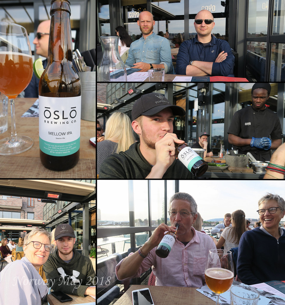
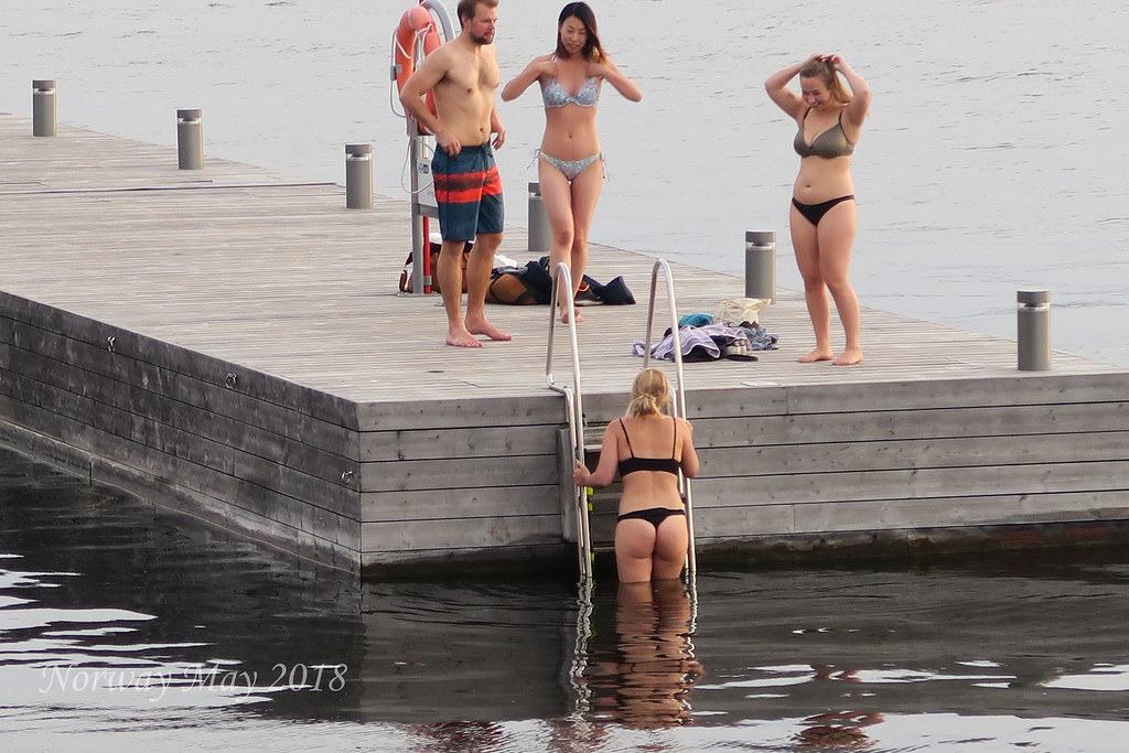
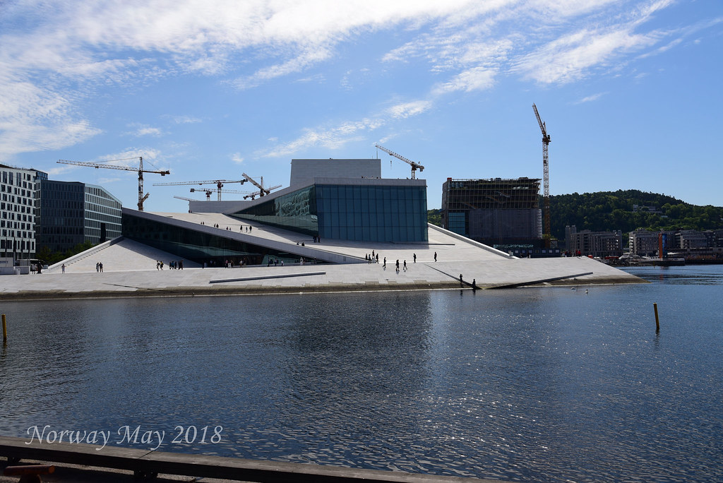
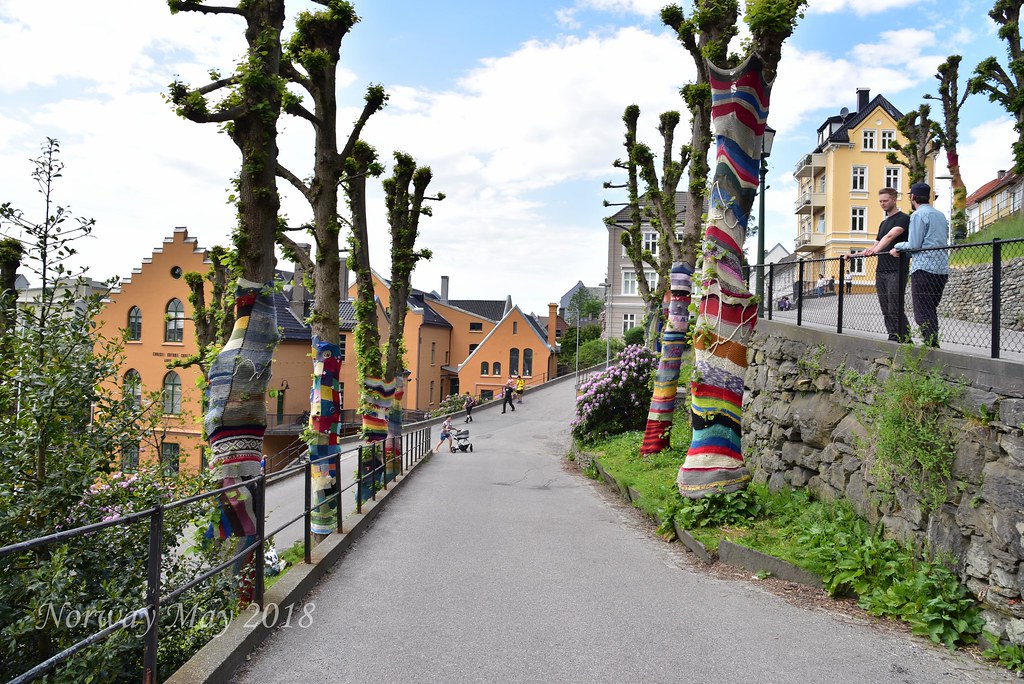
The cost to park for 24 hours is $35.00 USD. We would soon find out this price was a deal. Our apartment was located in the immigrant section of the city. Lots of folks in this area are from Turkey and Tunisia. This gave the area a nice international flair. It was 7 PM by the time we had gotten settled. The sun was still high in the sky and the temperature a nice 75°. Hot Spot knew of a nice area about a mile from our apartment, along the water to have dinner. As we walked to the waterfront we quickly saw how modern Oslo is and how fast it is growing. It was impossible to look across the skyline and not see construction cranes. It was near 8:30 PM when we reached a nice Mexican Restaurant, named Coyo. Coyo is just passed the Opera House along the waterfront. The sun was still high in the sky. People were out sunbathing and even taking a quick swim in the frigid water. We had an excellent dinner, though we all laughed, our first night in Oslo and we had Mexican food. After dinner it was off to sleep, it had been a long day.
Day One - Oslo
 Hot Spot departed the apartment before we woke, he had an early flight back to Amsterdam. Oslo like many cities we have visited has a Free Walking Tour. We decided to do the 10 AM tour. Our guide, a university student from Latvia, spoke perfect English. She gave a great tour, it lasted just over two hours and gave us a nice feel for the city. Here are a few fun facts we learned:
1) The reason there is no Nobel Prize for mathematics? The first love of Mr. Noble's was stolen away by a mathematician.
2) Mr. Noble made his money by discovering TNT also known as dynamite.
3) Norway has a huge sovereign wealth fund created from the sale of their oil reserves.
4) 95% of Norway's energy comes from renewable sources.
5) There was a fire that burned for three days and three nights which destroyed most of Oslo City Center.
Hot Spot departed the apartment before we woke, he had an early flight back to Amsterdam. Oslo like many cities we have visited has a Free Walking Tour. We decided to do the 10 AM tour. Our guide, a university student from Latvia, spoke perfect English. She gave a great tour, it lasted just over two hours and gave us a nice feel for the city. Here are a few fun facts we learned:
1) The reason there is no Nobel Prize for mathematics? The first love of Mr. Noble's was stolen away by a mathematician.
2) Mr. Noble made his money by discovering TNT also known as dynamite.
3) Norway has a huge sovereign wealth fund created from the sale of their oil reserves.
4) 95% of Norway's energy comes from renewable sources.
5) There was a fire that burned for three days and three nights which destroyed most of Oslo City Center.

After the tour, we decided to wander the city. Our goal reaching Vigeland Park the walk was several miles but worth it. The park has many nude statues showing all kinds of human emotions, joy, happiness, sadness, etc. The reason the statues are naked is to show the pure emotion in human expression. It is a very interesting park and exhibit. Since the height of the tourist season has not started the crowds in the park where not very thick. We heard this park can be a mob scene.
We continued our walk heading back through the city to the waterfront. Once at the waterfront, we
 enjoyed a beer and chatted with the locals. We had walked over 14 miles and felt we had gotten a good sense of Oslo. For this reason, we decided we would head out of the city the next morning. It would be time to tour the countryside. I almost forgot to mention, this goes back to the theme of Norway being expensive. Public Toilets cost about $1.25 and in case you do not have cash they take credit cards.
Day 2 - Oslo - Flam
The small picturesque village of Flåm, is situated innermost in the Aurlandsfjord and is home of the Flåm Railway. Flåm is nestled innermost in the Aurlandsfjord, an arm of the 204-km long and up to 1308- metre-deep Sognefjord. Flåm is the end station of the popular Flåm Railway, which is included in several of our popular round trips.
The village has a population of approximately 400 inhabitants and it is situated in Aurland municipality, which consists of Flåm, Aurland, Gudvangen and Undredal. In 1980 most of the people in Flåm were farmers, today most of the inhabitants work in the tourism industry or with the railway. Today Flåm is one of the most popular cruise harbors in Norway.
 The origins of the flourishing tourism trade in Flåm, date back to the end of the 19th century, when large numbers of English tourists, also called "salmon lords", came to fish in the Flåm river. These travelers laid the foundation for hotels to be established and a steady stream of tourists, who were transported in two-wheeled buggies through the spectacular scenery. After the Bergen Railway was opened in 1909 Flåm became a crossroads for passengers, post and freight traveling on the trains between Oslo and Bergen and on the steamships on the fjord.
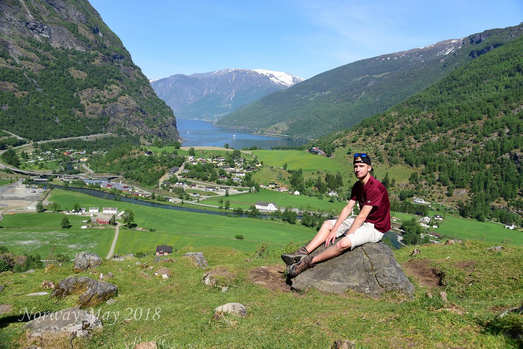
We departed Oslo for Flam (a 5 plus hour drive) at 9 AM. Traffic was heavy until we got out of the city center. We took the E18 to the E16 to the 7. Once on the 7, the scenery changed. The views beautiful, high mountains, we could even see snow off in the distance. At Gol, we followed the 7 toward Hagafoss. At Hagafoss, we turned off the 7 onto the 50 which would connect us back to the
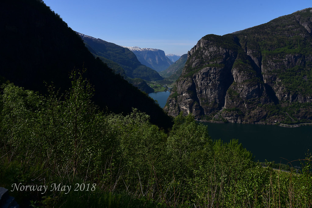 E16 just outside Flam. This route takes the same time as the highway (E16 the entire way), but the roads are smaller, less traveled, and more scenic.
We stopped for lunch at a hotel restaurant called Storestolen Fjellstue, about 40 minutes outside of Flam. The food was great, the boys all had reindeer with potatoes and veggies, Margarite had freshly caught trout. This area is known for being a winter resort, skiing, snowmobiling etc. Being between seasons, not much was opened. We were very happy to stumble across this great gem.
Leaving Storestolen Fjellstue we continued on the 50 for what would be the most beautiful part of the drive. Passing through 16 tunnels along the windy road down to the bottom of the Fjord. Flam is a very small town at the base of the Aurlands Fjord. Most people arrive via the Flam Railroad which is supposed to be a beautiful trip.
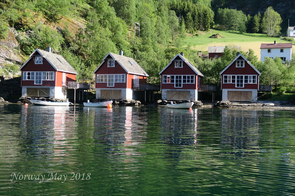
We arrived at Flam at 4:00 PM. The cabin we rented was beautiful right on the water, it included a boat. Anders the owner gave us a quick lesson on how to use the boat. After the boat lesson, we walk to the co-op to shop for food. As I mentioned before, Norway is expensive, food is no exception. Grocery bill, $112 USD for two meals and a few snacks.
After dinner we took a walk to town, it was 9:30 PM the still sun high in the sky. At 10:30 PM we called it a day, the sun still bright.
Day 3 - Flam
We scheduled a Fjord Safari for 9:30 AM. The tour would be a 2 1/2 hour ride in a zodiac type rib boat. We toured different areas of the Fjord. We learned this is the second largest fjord in the world, with the largest being in Greenland. We also got a bit of a history lesson. Land use was picked strategically to protect the villages from enemy attacks.
We also learned how important access to the sun is for the farmers. With the fjord's steep canyon walls, having your farm in the wrong location can significantly reduce down the amount of sunlight your crops get per day.
Video - Fjord Safari
After the fjords safari, we had fish and chips from a street vendor. The calamari tasted like fried rubber and Dan the Man Jr. got sick from the fish. Not such a great lunch but sticking with Norway
 tradition, it was an expensive lunch.
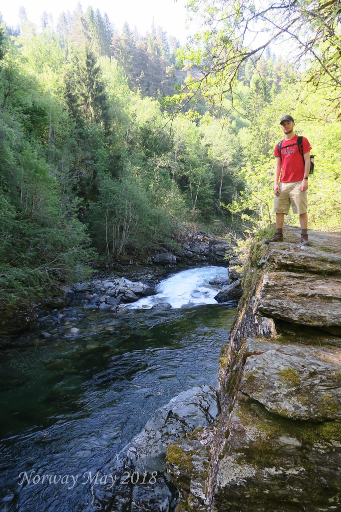
After lunch, we took a 4.5-mile hike to the large waterfall named Brekkefossen Waterfall that drops from the plateau into the river. From the plateau, we could not only see the beautiful falls we got a great view of Flam and the fjord.
While Margarite prepares dinner, Dan the Man Jr. and I took the boat for a quick spin around the fjord.
Margarite made a great meal. The sun setting at near midnight is driving us all nuts. We finished dinner at 9 PM but thought it was 6 PM, the sun still high in the sky.
Day 4 - Flam to Voss
Voss is a municipality and a traditional district in Hordaland county, Norway. The administrative center of the municipality is the village of Vossevangen. Other villages include Bolstadøyri, Borstrondi, Evanger, Kvitheim, Mjølfjell, Oppheim, Stalheim, and Vinje.
The 1,806-square-kilometre (697 sq mi) municipality is the 38th largest by area out of the 422 municipalities in Norway. Voss is the 81st most populous municipality in Norway with a population of 14,514. The municipality's population density is 8.4 inhabitants per square kilometre (22/sq mi) and its population has increased by 5.3% over the last decade.
The parish of Voss was established as a municipality on 1 January 1838 . On 1 January 1867, a small area in northern Voss (population: 28) was transferred to the municipality of Hosanger. On 1 January 1868, the northern district of the municipality (population: 2,009) was separated to form the new municipality of Vossestrand. This left 7,592 residents in Voss. On 21 August 1868, an unpopulated area of northern Voss was transferred to Vossestrand. Then, on 1 January 1885, the western district of Voss (population: 2,045) was separated to form the new municipality of Evanger. This left Voss with 5,403 residents.
During the 1960s, there were many municipal mergers across Norway due to the work of the Schei Committee. On 1 January 1964, the municipality of Voss (population: 10,575), the municipality of Vossestrand (population: 1,573), and most of the municipality of Evanger (population: 1,075) were all merged into a new, larger municipality of Voss. (The rest of Evanger was merged into the new municipality of Vaksdal.) On 1 January 2020, the neighboring municipality of Granvin will be merged into Voss, creating a larger municipality that will also be called Voss.

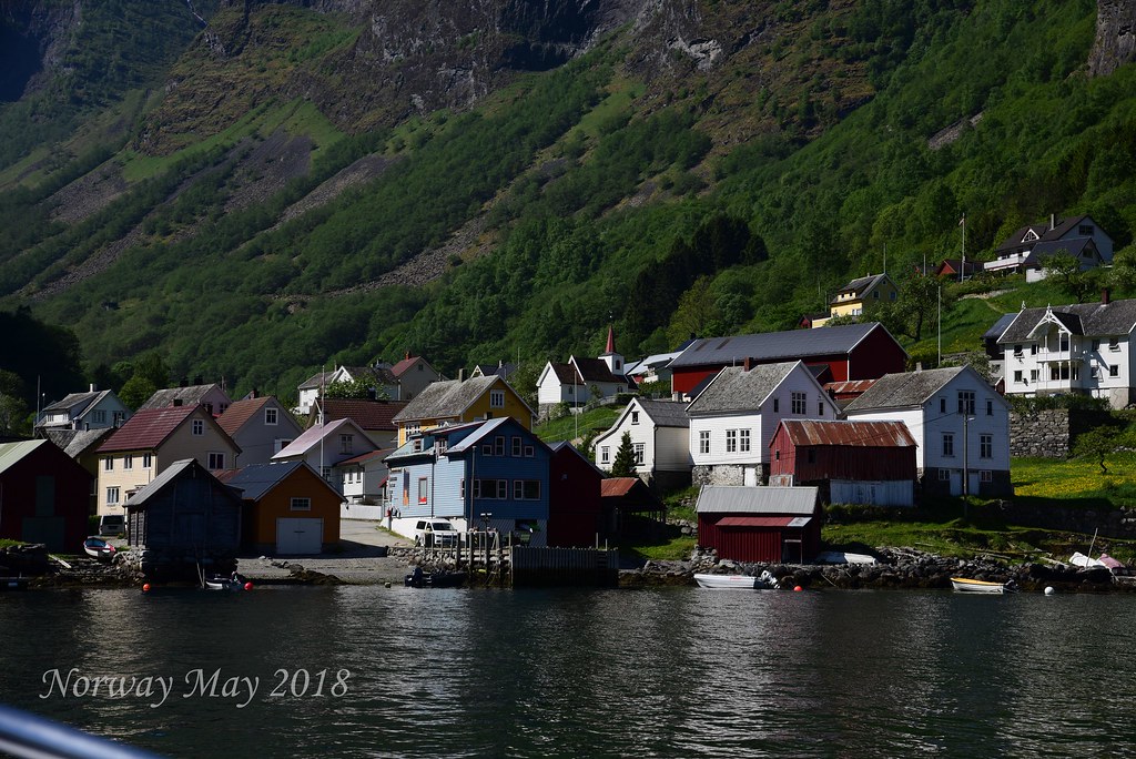
Today we left Flam for Voss. Our first stop was Undredal a small town about 15 minutes from Flam. We actually went by Undredal during our Fjord Safari the day before. The town has a population of 60 people and hundreds of goats. Undredal is famous for two things, the smallest church in all of Europe, and goat cheese. We toured the church and tasted and bought the best goat cheese.
The next stop was a town called Gudvangen, another town we saw from the water the day before. Gudvangen sits at the end of the fork in the fjord, opposite Flam. Gudvangen was a tourist trap so we quickly left.
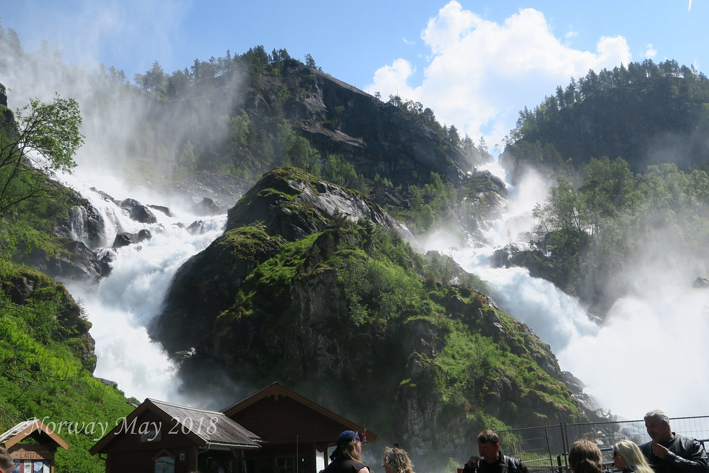
The drive towards Voss was beautiful passing through green valleys and climbing mountains. Just a few minutes outside Voss we stopped at a multi-tiered waterfall named Tvindefossen.
We arrived at our apartment just past 2 PM. The apartment was centrally located in Voss right across from the Tre Bror Kafe og Bar.

We decided lunch was in order. Being so close we would try the Tre Bror Kafe og Bar. The food and the beer were great, but much like other parts of Norway, very expensive. We walked the small town of Voss before calling it a day. It was late Friday afternoon most of the shops were closed the town was dead.
Day 5 - Voss
In the morning we hiked to Bordalsgjelet Gorge, 4 miles round-trip. The gorge was a disappointment.
The issue is the sun being so high in the sky, shadows are created making it hard to photograph and see the real beauty.
At 2 PM we departed for Voss Active for our white water rafting trip. Our guide Ryan was great. We first did a mile training run to get everybody used to the boat and commands. Then we each did a test swim through the rapids.
Once everybody was comfortable with white water rafting, we did several miles of Class IV Rapids. Yes, I got tossed out of the boat. The rafting trip included dinner and a slide show. During the slideshow, we saw pictures taken on that days trip. The rafting wore us out. Off to bed, we went.
Video - White Water Rafting
Day 6 - Voss
This morning we have scheduled a mountain bike trip through Outdoor Norway, the owner Marcio Franco is our guide. Margarite has a hamstring issue so she got an electrically assisted mountain bike. This gave her some extra power on the up hills. We drove about 30 minutes outside of Voss into the mountains to start our ride. Once on the biked we zigzagged our way down, back into Voss. The entire trip was two hours of fairly technical mountain biking. Being Dan the Man Jr.‘s first outing on a mountain bike he did great, a little beat up but he did great.
Video - Mountain Biking
Lunch was at Inside Voss, they had all different kinds of burgers. As usual $25 USD a burger. In the afternoon we attempted to hike Mount Hanguren. I say attempted because we did not notice the sign saying the trail was closed. We made it about 3/4 of the way before we reach the barricades. All in all, a good hike, with great views. Since we had a late lunch, we decided on just snacks for dinner, before calling it a day.
Day 7 Voss to Bergen
Bergen, historically Bjørgvin, is a city and municipality in Hordaland on the west coast of Norway. At the end of the first quarter of 2016, the municipality's population was 278,121, and the Bergen metropolitan region has about 420,000 inhabitants. Bergen is the second-largest city in Norway. The municipality covers 465 square kilometers (180 sq mi) and is on the peninsula of Bergenshalvøyen. The city centre and northern neighborhoods are on Byfjorden, 'the city fjord', and the city is surrounded by mountains; Bergen is known as the 'city of seven mountains'. Many of the extra-municipal suburbs are on islands. Bergen is the administrative centre of Hordaland, and consists of eight boroughs - Arna, Bergenhus, Fana, Fyllingsdalen, Laksevåg, Ytrebygda, Årstad, and Åsane.
Trading in Bergen may have started as early as the 1020s. According to tradition, the city was founded in 1070 by king Olav Kyrre and was named Bjørgvin, 'the green meadow among the mountains'. It served as Norway's capital in the 13th century, and from the end of the 13th century became a bureau city of the Hanseatic League. Until 1789, Bergen enjoyed exclusive rights to mediate trade between Northern Norway and abroad and it was the largest city in Norway until the 1830s when it was surpassed by the capital, Christiania (now known as Oslo). What remains of the quays, Bryggen, is a World Heritage Site. The city was hit by numerous fires over the years. The Bergen School of Meteorology was developed at the Geophysical Institute beginning in 1917, the Norwegian School of Economics was founded in 1936, and the University of Bergen in 1946. From 1831 to 1972, Bergen was its own county. In 1972 the municipality absorbed four surrounding municipalities and became a part of Hordaland county.
The city is an international centre for aquaculture, shipping, offshore petroleum industry and subsea technology, and a
 national centre for higher education, media, tourism and finance. Bergen Port is Norway's busiest in terms of both freight and passengers with over 300 cruise ship calls a year bringing nearly a half a million passengers to Bergen, a number that has doubled in 10 years.[3] Almost half of the passengers are German or British. The city's main football team is SK Brann and the city's unique tradition is the buekorps. Natives speak a distinct dialect, known as 'Bergensk'. The city features Bergen Airport, Flesland, Bergen Light Rail, and is the terminus of the Bergen Line. Four large bridges connect Bergen to its suburban municipalities.
Bergen has a mild winter climate, though with a lot of precipitation. During December - March, the temperature difference between Bergen and Oslo can be up to 30 degrees Celsius, despite the fact that both cities are at approximately 60 degrees North. The Gulf Stream keeps the sea relatively warm, considering the latitude, and the mountains protect the city from cold winds from the north, north-east and east.
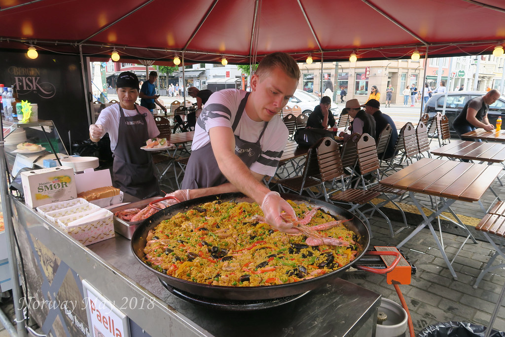
 The drive from Voss to Bergen was beautiful, passing from Valley to Valley through tunnels carved through the mountains. Some of the tunnels more than 10 km long. We arrived in Bergen at noon and headed to the fish market for lunch. The fish market is on the harbor and is very much a tourist attraction/trap. Many vendors selling all different kinds of fish and seafood. Some to take with you and some to eat there. We all picked our favorite foods and enjoyed our lunches.
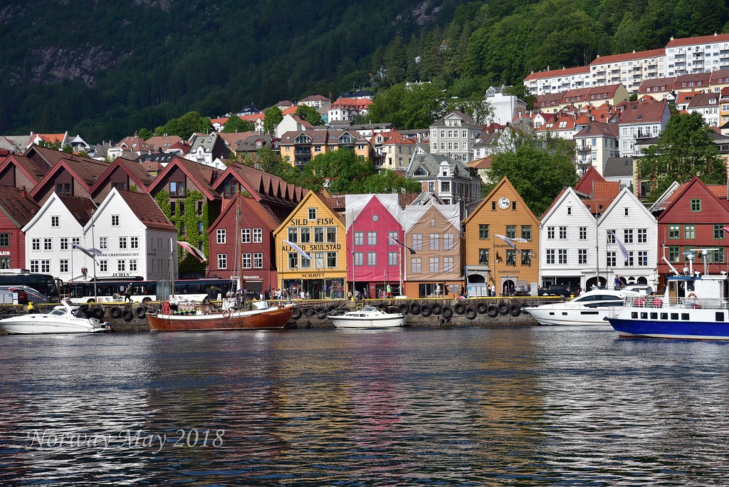
After lunch, we spent hours just walking the streets of Bergen. Bergen has a lot more character than Oslo. Many of the buildings are older and seemed more of what we expected to see of the architecture of Norway.
Day 8 - Bergen
This morning we visited the Norwegian Knitting Industry Museum, a 30-minute drive outside of Bergen. The knitting museum is a converted factory that made undergarments from cotton imported
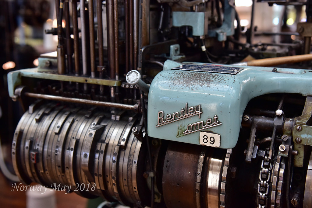 from the US and wool from Norway. The factory operated from the 1800s to the late 1900s. The factory finally closed when they could no longer compete with lower wage labor from China.
After the museum, we had lunch back in Bergen, before hiking to the top of one of the surrounding hillside (320 Meters up). We could’ve taken the Fløibanen funicular. We decided to save the funicular for when we are old and tired. The views from the top of the hillside are breathtaking. We could also now see and understand how Bergen was built around the harbor.
It has been a long day so we just vegged out at the apartment, before going to sleep.
Day 9 - Bergen to Stavanger
Stavanger is a city and municipality in Norway. The city is the third-largest urban zone and metropolitan area in Norway (through conurbation with neighboring Sandnes) and the administrative centre of Rogaland county. The municipality is the fourth most populous in Norway. Located on the Stavanger Peninsula in Southwest Norway, Stavanger counts its official founding year as 1125, the year the Stavanger Cathedral was completed. Stavangers core is to a large degree 18th- and 19th-century wooden houses that are protected and considered part of the city's cultural heritage. This has caused the town centre and inner city to retain a small-town character with an unusually high ratio of detached houses, and has contributed significantly to spreading the city's population growth to outlying parts of Greater Stavanger.
The city's rapid population growth in the late 20th century was primarily a result of Norway's booming offshore oil industry. Today the oil industry is a key industry in the Stavanger region and the city is widely referred to as the Oil Capital of Norway. The largest company in the Nordic region, Norwegian energy company Statoil is headquartered in Stavanger. Multiple educational institutions for higher education are located in Stavanger. The largest of these is the University of Stavanger.
Domestic and international military installations are located in Stavanger, among these is the North Atlantic Treaty Organization's Joint Warfare Center. Other international establishments, and especially local branches of foreign oil and gas companies, contribute further to a significant foreign population in the city. Immigrants make up 11.3% of Stavanger's population. Stavanger has since the early 2000s consistently had an unemployment rate significantly lower than the Norwegian and European average. In 2011, the unemployment rate was less than 2%. The city is also among those that frequent various lists of expensive cities in the world, and Stavanger has even been ranked as the world's most expensive city by certain indexes.
Stavanger is served by international airport Stavanger Airport, Sola, which offers flights to cities in most major European countries, as well as a limited number of intercontinental charter flights. The airport was named most punctual European regional airport by flightstats.com in 2010.
Every two years, Stavanger organizes the Offshore Northern Seas (ONS), which is the second largest exhibition and conference for the energy sector. Gladmat food festival is also held each year and is considered to be one of Scandinavia's leading food festivals. The city is also known for being one of the nation's premier culinary clusters. Stavanger 2008 European Capital of Culture.
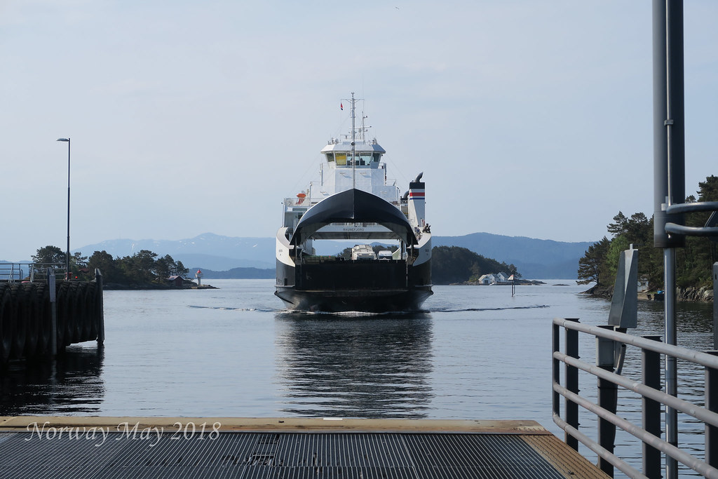
The drive from Bergen to Stavanger is along the west coast of Norway, heading due South. The 5-hour drive includes two ferry crossings 40 minutes each. The terrain changed as we continued south, grass fields with large granite boulders. It was like the ice glaciers just drop boulders where ever they felt on the way to the sea. Dotting the fields with these large boulders.
Stavanger was larger than we expected. The third largest metropolitan area in Norway. We arrived about 3 PM, got situated and then headed out to find our meeting place. The main reason we are in Stavanger is to hike Kjerag. We hired a guide and are to meet them the next morning at 4:55 AM at the Tourist Information Center.

We found our meeting spot and then headed to Sabi Sushi to get a late lunch early dinner. Sabi Sushi is known throughout Europe as the go-to place for the best sushi. We each ordered the chefs choice. We each got something different and no one was disappointed.
It was now time to prepare for the next day's hike and get to bed early, as we had a 4 AM wake up call.
Day 10 - Hiking Kjerag
This time a year Norway could still have snow. For this reason, we booked a guide, just in case Outdoor Life Norway. We met our guide Otto at the Stavanger Tourist Center at 4:55 AM. Along with Otto, his assistant guide Pedro will be joining us. After we left the tourist center we picked up a French family of four, and two ladies from Vienna. The 10 of us will be hiking together.
 snowshoes or ice cleats were needed. We booked with a company called
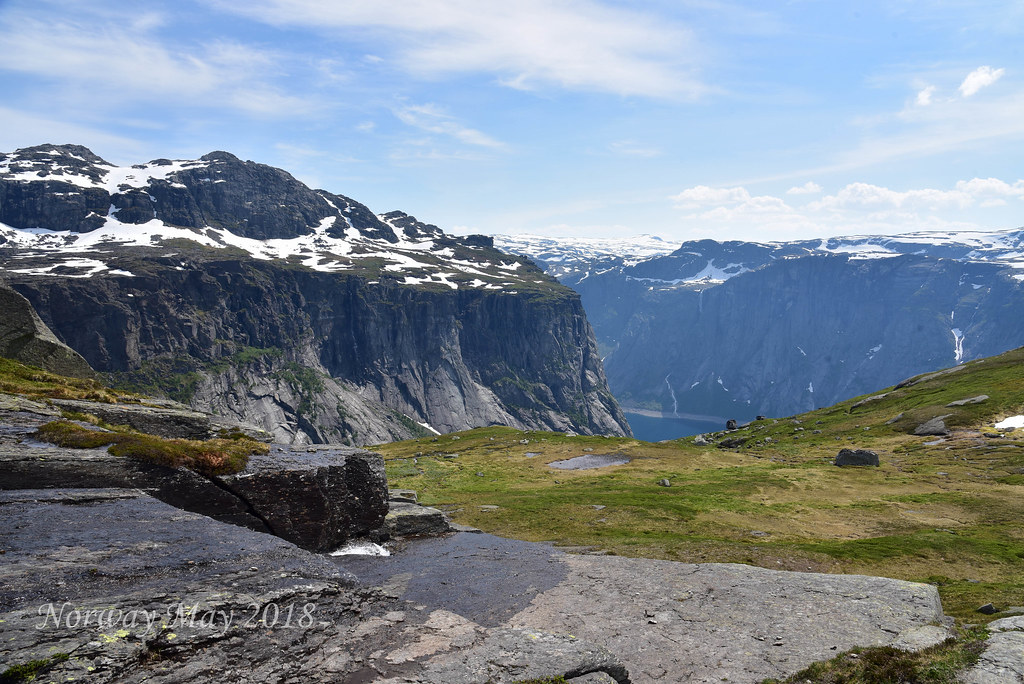
The trailhead for Kjerag is either a drive and ferry or just the drive. Either way, it is about two hours to get to the trailhead. For our hike, we will do the drive/ferry to get to the trailhead and do the drive to get back to Stavanger.
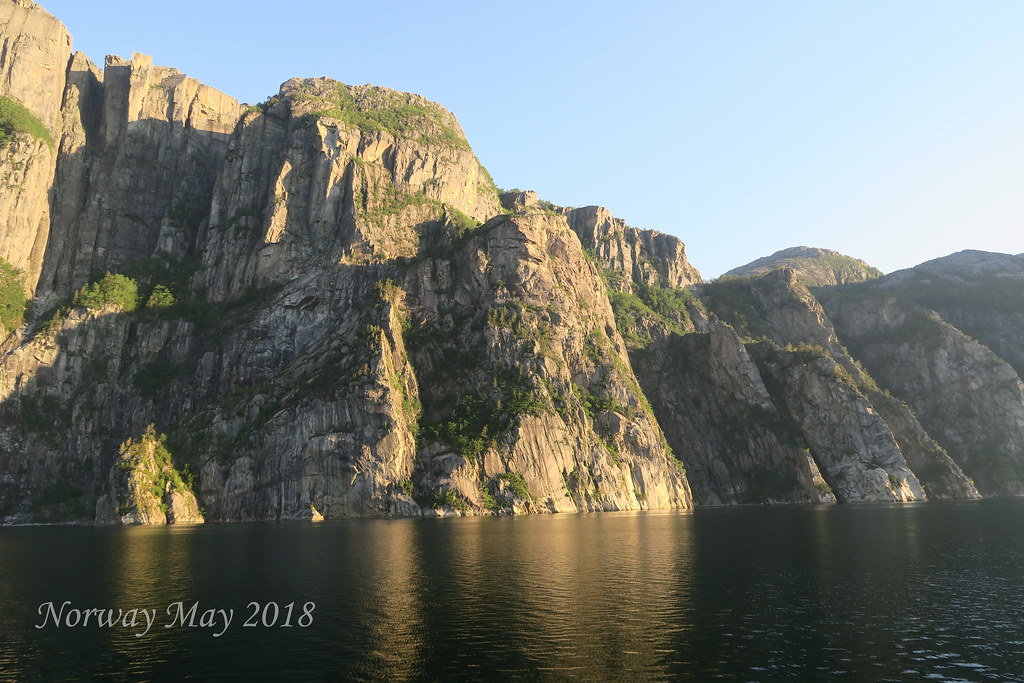
The ferry was smaller than the two ferries we had been on the day before. This ferry only carried a few cars compared to the day before where the ferries could carry hundreds of cars. The ferry ride was through a narrow fjord, with granite walls thousands of feet straight up.
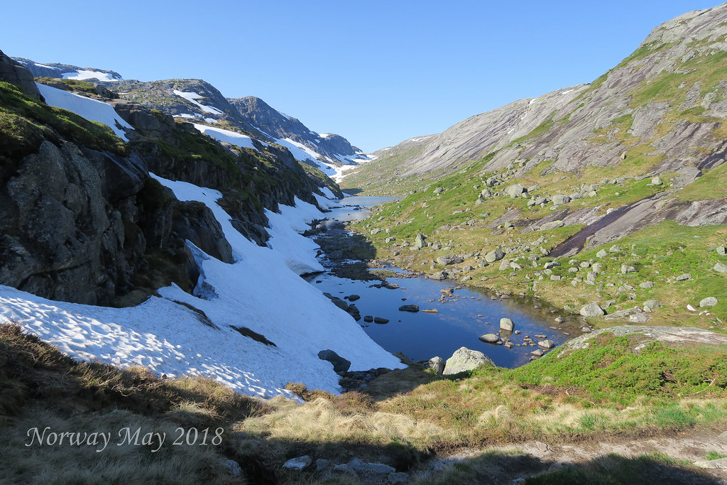
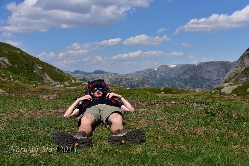
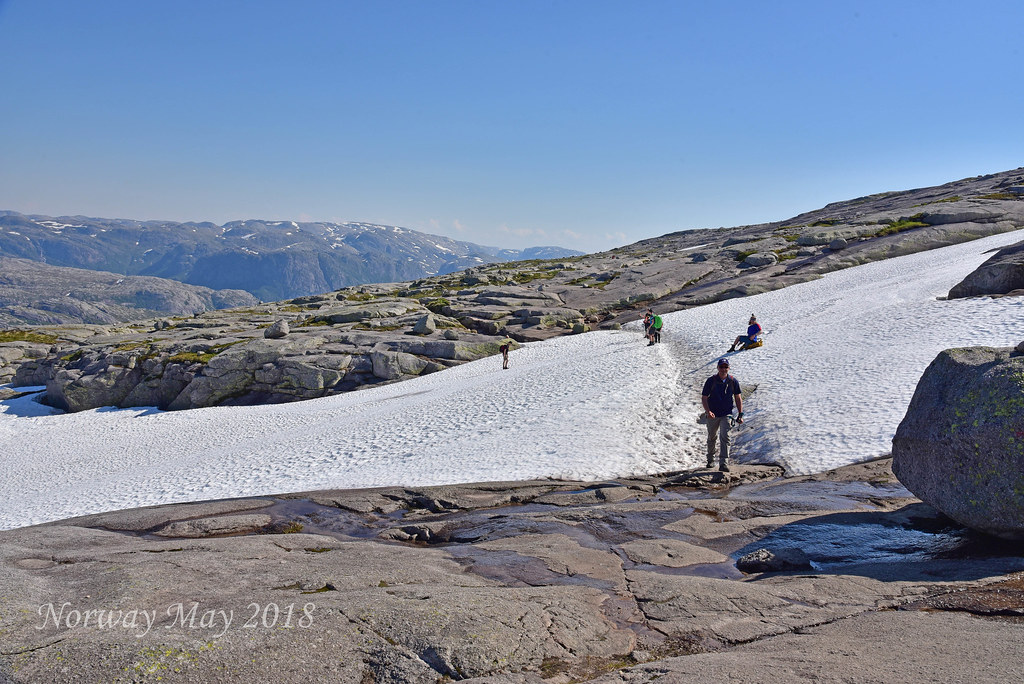 Once we arrived in the town of Lysebotn we continued in the van up a very windy road to Oygardstol. Oygardstol is where the hike starts. Our group seems fit and with 10 hikers and two guides, we should be in for a nice day. The weather continues to be spectacular. Clear skies and warm temperatures. The wind was moderate which was nice as it kept us from overheating. The hike is not very long just over10 km round-trip about 6 miles. What makes this hike a challenge is the ups and downs. Some areas are so steep they’ve installed cables so you can pull yourself up or lower yourself down. Even though it is warm some areas still have snow on the ground. This made for some fun snowball fights. One negative of taking a group hike is you need to take breaks as a group. We took more breaks than we would’ve if we had been on our own, but it gave us time to take in all the beauty of the area.
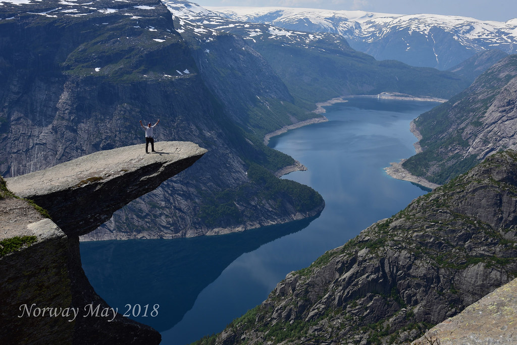
The main purpose of hiking Kjerag is to reach the suspended Boulder. The forming of this natural structure is a testament to the power of the ice glacier. In this case, as the glacier moved, it carves a crevice while at the same time carrying this huge boulder. When the ice melted it dropped the boulder into the crevice.
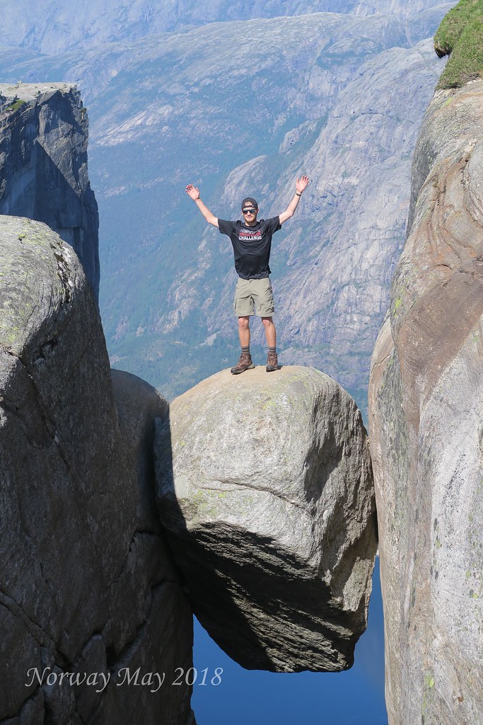
Once we reached the boulder Otto gave us instructions on how to get out onto the rock. He said the most important instruction was, whatever you do, "DO NOT LOOK DOWN!" the drop is over 800 meters. Margarite and I volunteered to take pictures as each person took their turn going out onto the boulder.
The hike back was just as beautiful, with magnificent views of the fjord. The road that we took back to Stavanger has an interesting story. The town that the ferry drop this off at, Lysebotn has about eight full-time residence but supplies all the electrical power to the city of Stavanger. There are glacier lakes far above the town of Lysebotn. The Norwegians cut tunnels under these lakes creating powerful waterfalls. They then installed turbines inside these tunnels. The turbines turn generators creating electrical power.
In order to get this power to Stavanger power lines needed to be run. To run the power lines a road needed to be built. That is the story behind the road we were now driving on.

Video - Hiking Kjerag
It has been a long day the Tourist Center where we parked is right at the harbor which has many shops and restaurants. We decided to enjoy the beautiful weather and have a drink and some dinner at a restaurant named Mexico. I know we have now had Mexican, Hamburgers, Sushi, and now Mexican again. What about Norwegian food. That is a whole other story. The food and margaritas were nice. The negative was we had to move inside because of all the smokers. This was not unique to Mexico or Stavanger. We have noticed throughout the trip. My guess 90% of Norwegian smoke. This is across the board for all ages all sexes.
All in all, we had a great day. A long day, it was close to 8 PM by the time we got back to the house.
Day 11 - Stavanger to Odda
Odda is a municipality in Hordaland county, Norway. The municipality is located in southeastern Hordaland county, surrounding the southern end of the Sørfjorden. The administrative centre is the town of Odda, which is also the main commercial and economic centre of the entire Hardanger region. Other villages in the municipality include Botnen, Eitrheim, Håra, Røldal, Seljestad, Skare, and Tyssedal.
The 1,616-square-kilometre (624 sq mi) municipality is the 42nd largest by area out of the 422 municipalities in Norway. Odda is the 150th most populous municipality in Norway with a population of 7,025. The municipality's population density is 4.8 inhabitants per square kilometre (12/sq mi) and its population has decreased by 1.8% over the last decade.
In 1927, Erling Johnson, working at Odda Smelteverk, invented a process to produce three component, NPK fertilizers. This process is now known as the Odda process.
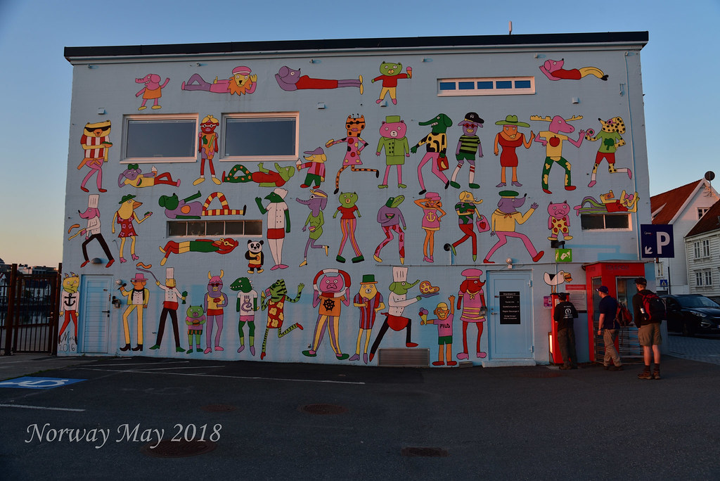
Today we will be driving to Odda from Stavanger. Before heading to Odda, Margarite and I got up early, 5:00 AM to walk the town and take pictures. With the sun rising and setting so early and late it is tough to take pictures without getting shadows. Stavanger has some cool murals and parks and we wanted to get some photographs before the sun was high in the sky.

After the photo session and some breakfast, we got on the road. First, we backtracked towards Bergen taking the second ferry we had taken just two days before. At some point, after exiting the ferry we turn northeast until we reach Odda a small town sitting on the edge of a fjord. Before arriving at Odda, we pass by several large waterfalls. We stopped at a couple to take pictures and get a break from the drive.
Margarite had found an industrial museum we could visit named Norwegian Museum of Hydropower and Industry. We visited the museum before checking in and getting ready for the next days' hike. The museum had to do with the history of Odda and the coming of the power plant. Odda had been a poor farming community until some foreigners bought the local waterfall at first to make it a tourist destination and then to build an electrical generating plant. This brought cheap electricity to the area which brought manufacturing, which helped grow the town of Odda.

After checking into our apartment and doing some grocery shopping we headed to the Trolltunga Hotel. We had a 9:00 PM orientation meeting for our next days' hike. We had hired a guide from a company called Trolltunga Active (http://trolltunga-active.com/activities/hiking-and-biking/). BIG MISTAKE. The orientation meeting gave us an overview of what we needed and what to expect. We needed to depart the next morning at 7 AM. We departed the hotel back to our apartment to hit the hay.
Day 12 - Trolltunga Hike
Trolltunga (Troll tongue) is a rock formation situated about 1,100 metres above sea level in the municipality of Odda in Hordaland county, Norway. The special cliff is jutting horizontally out from the mountain, into free air about 700 metres (2,300 ft) above the north side of the lake Ringedalsvatnet.
Popularity of the hike to Trolltunga and rock formation itself has exploded in recent years. The increased popularity has turned Trolltunga into a national icon and a major tourist attraction for the region. Until 2010, less than 800 people hiked to Trolltunga each year. In 2016 more than 80,000 people hiked the 27 kilometres round-trip from Skjeggedal, making it one of Norway's most popular hikes.
We met at Trolltunga Active just before 7:30 AM, which was the scheduled departing time. Trolltunga Active is in Skjeggedal. We were told because of the chaos we would be delayed. We did not the depart until 8:30 AM.
 The hike starts out on a steep uphill climb. While steep it was not hard as the trail was made with steps cut from granite. Sherpas from Nepal were hired to build this trail. They did a beautiful job. There were 22 hikers in our group, way too many and unsafe.
After just 10 minutes we stopped for a break, we stopped on a small landing only a few people could fit. The rest of the hikers had to stand on small granite steps. Then I realize why we stopped two more hikers showed up. They had shown up late so we had to wait. With 24 hikers, unless you are one of the first few the only scenery you see is the backs, buttocks, and legs of other hikers. After about an hour of this and several breaks, we had enough. We told the guide we would go ahead on our own. A total waste of 1100 Norwegian Kroner. BIG MISTAKE hiring Trolltunga Active.

The hike was 28 km 17 miles, with 3000 feet of elevation change. It was a challenging hike, but just as beautiful as the other hikes in Norway great views of the granite walls of the fjords. We crossed many streams created by melting snow. We also crossed many snowfields. One nice thing when hiking in Norway all the water from the streams is drinkable. This allows you to carry less water which means last weight. The hike is out and back at the turnaround point which is the sheer drop. A rock protrudes out of the cliff side creating what looks like a dive platform. The name Trolltunga comes from people saying the platform is a trolls tongue. Each hiker takes a turn and goes on to the platform to have their picture taken.
The line when we arrive was about 25 hikers long. "Z" and Dan the Man Jr. waited as we took their pictures. When we left it was 2 PM. Our original group of hikers was just arriving a full hour after us. The hike back was tough we were all tired, it had been a long day. We are very happy we left our group. Who knows what time they finish the hike.

NEVER USE TROLLTUNGA ACTIVE
We washed up and hit the hay it had been a long day.
Day 13 - Oda to Drammen
This will be our last full day in Norway we have over a 5-hour drive to get close to Oslo for our next
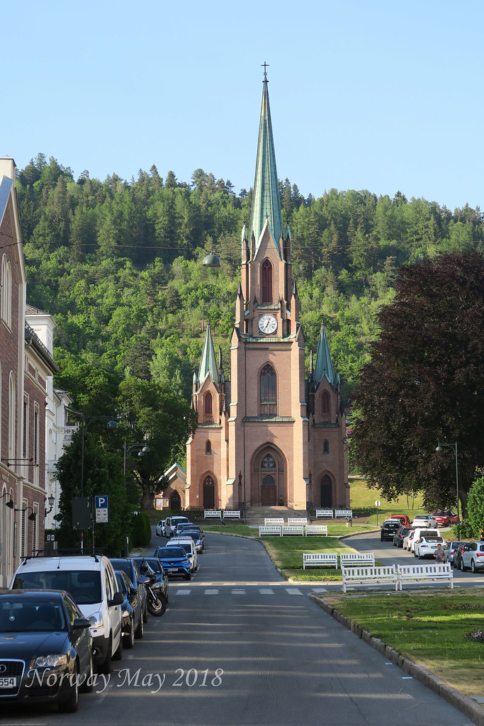 days' flight. The drive was long but past through many different terrains of Norway. We arrived in Drammen at 4 o’clock got checked into our hotel. Drammen is a small town about 40 minutes southwest of Oslo. We tried Drammen to change it up a bit and just save the trouble of adding another 40 minutes to our drive.
A quiet little town on the river. We walked a bit before finding a nice little place for drinks and dinner on the river. It took hard work to get a table that was outside and still not surrounded by smokers, Margarite found one.
Day 14 - Time to go home.
Our flight is not until 2:45 PM. With the extra time, we decided to go to the Munch Museum in Oslo. It was well worth the stop. The art was interesting and the setup/flow of the museum was well thought out.
That’s it from Norway.
Cheers,
DUG
All Pictures
As you may remember we met Hot Spot also know as our "New Best Friend Kevin" in Japan last November. Hot Spot contacted me in March. He asked if I could get him a Sony A 7 II Camera Body and a Lens. My response was, why?
To make a long story short Hot Spot lives in the EU which has high import duties and a large Value Added Tax (VAT). These taxes increased the price of this equipment by about 35%. I did a little research and found I could get Hot Spot this equipment at significant savings. The next question, how to get the equipment to Hot Spot. We discovered if I shipped the equipment, customs would impose all the taxes when Hot Spot receives the equipment. Shipping is not an option. Next options lets meet somewhere and make the exchange in person. We picked Norway. Traveling with me will be Margarite, Dan the Man Jr., and "Z". Traveling with Hot Spot will be Dina.
Oslo -
Oslo is the capital and the most populous city in Norway. It constitutes both a county and a municipality. Founded in the
Oslo is the economic and governmental centre of Norway. The city is also a hub of Norwegian trade, banking, industry and shipping. It is an important centre for maritime industries and maritime trade in Europe. The city is home to many companies within the maritime sector, some of which are among the world's largest shipping companies, shipbrokers and maritime insurance brokers. Oslo is a pilot city of the Council of Europe and the European Commission intercultural cities program.
As of 1 July 2017, the municipality of Oslo had a population of 672 061, while the population of the city's urban area was 942,084. The metropolitan area had an estimated population of 1.71 million. The population was increasing at record rates during the early 2000s, making it the fastest growing major city in Europe at the time. This growth stems for the most part from international immigration and related high birth rates, but also from intra-national migration. The immigrant population in the city is growing somewhat faster than the Norwegian population, and in the city proper this is now more than 25% of the total.
We arrived at 1 PM and decided to hang with Hot Spot until Dina's flight departed and Dan the Man Jr.’s flight arrived. Both would be at 4 PM. It was great to catch up with Hot Spot and meet Dina. We hung in the Airport Starbuck, can you be any less Norwegian than that.
Once Dina Departed and Dan the Man Jr. arrived, we got the rental car and headed into Oslo a 40-
We had heard Oslo was expensive and we quickly learned the rumor was fact. (This will be a common theme in this post.)
The cost to park for 24 hours is $35.00 USD. We would soon find out this price was a deal. Our apartment was located in the immigrant section of the city. Lots of folks in this area are from Turkey and Tunisia. This gave the area a nice international flair. It was 7 PM by the time we had gotten settled. The sun was still high in the sky and the temperature a nice 75°. Hot Spot knew of a nice area about a mile from our apartment, along the water to have dinner. As we walked to the waterfront we quickly saw how modern Oslo is and how fast it is growing. It was impossible to look across the skyline and not see construction cranes. It was near 8:30 PM when we reached a nice Mexican Restaurant, named Coyo. Coyo is just passed the Opera House along the waterfront. The sun was still high in the sky. People were out sunbathing and even taking a quick swim in the frigid water. We had an excellent dinner, though we all laughed, our first night in Oslo and we had Mexican food. After dinner it was off to sleep, it had been a long day.
Day One - Oslo
After the tour, we decided to wander the city. Our goal reaching Vigeland Park the walk was several miles but worth it. The park has many nude statues showing all kinds of human emotions, joy, happiness, sadness, etc. The reason the statues are naked is to show the pure emotion in human expression. It is a very interesting park and exhibit. Since the height of the tourist season has not started the crowds in the park where not very thick. We heard this park can be a mob scene.
We continued our walk heading back through the city to the waterfront. Once at the waterfront, we
Day 2 - Oslo - Flam
The small picturesque village of Flåm, is situated innermost in the Aurlandsfjord and is home of the Flåm Railway. Flåm is nestled innermost in the Aurlandsfjord, an arm of the 204-km long and up to 1308- metre-deep Sognefjord. Flåm is the end station of the popular Flåm Railway, which is included in several of our popular round trips.
The village has a population of approximately 400 inhabitants and it is situated in Aurland municipality, which consists of Flåm, Aurland, Gudvangen and Undredal. In 1980 most of the people in Flåm were farmers, today most of the inhabitants work in the tourism industry or with the railway. Today Flåm is one of the most popular cruise harbors in Norway.
We departed Oslo for Flam (a 5 plus hour drive) at 9 AM. Traffic was heavy until we got out of the city center. We took the E18 to the E16 to the 7. Once on the 7, the scenery changed. The views beautiful, high mountains, we could even see snow off in the distance. At Gol, we followed the 7 toward Hagafoss. At Hagafoss, we turned off the 7 onto the 50 which would connect us back to the
We stopped for lunch at a hotel restaurant called Storestolen Fjellstue, about 40 minutes outside of Flam. The food was great, the boys all had reindeer with potatoes and veggies, Margarite had freshly caught trout. This area is known for being a winter resort, skiing, snowmobiling etc. Being between seasons, not much was opened. We were very happy to stumble across this great gem.
Leaving Storestolen Fjellstue we continued on the 50 for what would be the most beautiful part of the drive. Passing through 16 tunnels along the windy road down to the bottom of the Fjord. Flam is a very small town at the base of the Aurlands Fjord. Most people arrive via the Flam Railroad which is supposed to be a beautiful trip.
We arrived at Flam at 4:00 PM. The cabin we rented was beautiful right on the water, it included a boat. Anders the owner gave us a quick lesson on how to use the boat. After the boat lesson, we walk to the co-op to shop for food. As I mentioned before, Norway is expensive, food is no exception. Grocery bill, $112 USD for two meals and a few snacks.
After dinner we took a walk to town, it was 9:30 PM the still sun high in the sky. At 10:30 PM we called it a day, the sun still bright.
Day 3 - Flam
We scheduled a Fjord Safari for 9:30 AM. The tour would be a 2 1/2 hour ride in a zodiac type rib boat. We toured different areas of the Fjord. We learned this is the second largest fjord in the world, with the largest being in Greenland. We also got a bit of a history lesson. Land use was picked strategically to protect the villages from enemy attacks.
We also learned how important access to the sun is for the farmers. With the fjord's steep canyon walls, having your farm in the wrong location can significantly reduce down the amount of sunlight your crops get per day.
Video - Fjord Safari
After the fjords safari, we had fish and chips from a street vendor. The calamari tasted like fried rubber and Dan the Man Jr. got sick from the fish. Not such a great lunch but sticking with Norway
After lunch, we took a 4.5-mile hike to the large waterfall named Brekkefossen Waterfall that drops from the plateau into the river. From the plateau, we could not only see the beautiful falls we got a great view of Flam and the fjord.
While Margarite prepares dinner, Dan the Man Jr. and I took the boat for a quick spin around the fjord.
Margarite made a great meal. The sun setting at near midnight is driving us all nuts. We finished dinner at 9 PM but thought it was 6 PM, the sun still high in the sky.
Day 4 - Flam to Voss
Voss is a municipality and a traditional district in Hordaland county, Norway. The administrative center of the municipality is the village of Vossevangen. Other villages include Bolstadøyri, Borstrondi, Evanger, Kvitheim, Mjølfjell, Oppheim, Stalheim, and Vinje.
The 1,806-square-kilometre (697 sq mi) municipality is the 38th largest by area out of the 422 municipalities in Norway. Voss is the 81st most populous municipality in Norway with a population of 14,514. The municipality's population density is 8.4 inhabitants per square kilometre (22/sq mi) and its population has increased by 5.3% over the last decade.
The parish of Voss was established as a municipality on 1 January 1838 . On 1 January 1867, a small area in northern Voss (population: 28) was transferred to the municipality of Hosanger. On 1 January 1868, the northern district of the municipality (population: 2,009) was separated to form the new municipality of Vossestrand. This left 7,592 residents in Voss. On 21 August 1868, an unpopulated area of northern Voss was transferred to Vossestrand. Then, on 1 January 1885, the western district of Voss (population: 2,045) was separated to form the new municipality of Evanger. This left Voss with 5,403 residents.
During the 1960s, there were many municipal mergers across Norway due to the work of the Schei Committee. On 1 January 1964, the municipality of Voss (population: 10,575), the municipality of Vossestrand (population: 1,573), and most of the municipality of Evanger (population: 1,075) were all merged into a new, larger municipality of Voss. (The rest of Evanger was merged into the new municipality of Vaksdal.) On 1 January 2020, the neighboring municipality of Granvin will be merged into Voss, creating a larger municipality that will also be called Voss.
Today we left Flam for Voss. Our first stop was Undredal a small town about 15 minutes from Flam. We actually went by Undredal during our Fjord Safari the day before. The town has a population of 60 people and hundreds of goats. Undredal is famous for two things, the smallest church in all of Europe, and goat cheese. We toured the church and tasted and bought the best goat cheese.
The next stop was a town called Gudvangen, another town we saw from the water the day before. Gudvangen sits at the end of the fork in the fjord, opposite Flam. Gudvangen was a tourist trap so we quickly left.
The drive towards Voss was beautiful passing through green valleys and climbing mountains. Just a few minutes outside Voss we stopped at a multi-tiered waterfall named Tvindefossen.
We arrived at our apartment just past 2 PM. The apartment was centrally located in Voss right across from the Tre Bror Kafe og Bar.
We decided lunch was in order. Being so close we would try the Tre Bror Kafe og Bar. The food and the beer were great, but much like other parts of Norway, very expensive. We walked the small town of Voss before calling it a day. It was late Friday afternoon most of the shops were closed the town was dead.
Day 5 - Voss
In the morning we hiked to Bordalsgjelet Gorge, 4 miles round-trip. The gorge was a disappointment.
The issue is the sun being so high in the sky, shadows are created making it hard to photograph and see the real beauty.
At 2 PM we departed for Voss Active for our white water rafting trip. Our guide Ryan was great. We first did a mile training run to get everybody used to the boat and commands. Then we each did a test swim through the rapids.
Once everybody was comfortable with white water rafting, we did several miles of Class IV Rapids. Yes, I got tossed out of the boat. The rafting trip included dinner and a slide show. During the slideshow, we saw pictures taken on that days trip. The rafting wore us out. Off to bed, we went.
Video - White Water Rafting
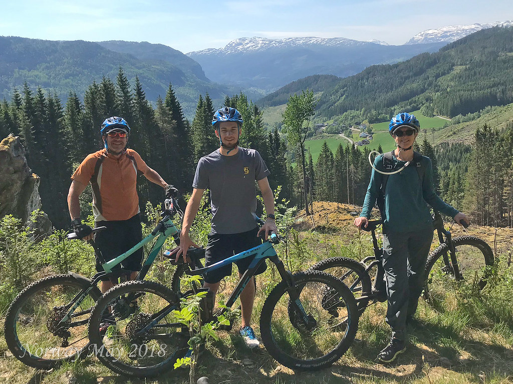
Day 6 - Voss
This morning we have scheduled a mountain bike trip through Outdoor Norway, the owner Marcio Franco is our guide. Margarite has a hamstring issue so she got an electrically assisted mountain bike. This gave her some extra power on the up hills. We drove about 30 minutes outside of Voss into the mountains to start our ride. Once on the biked we zigzagged our way down, back into Voss. The entire trip was two hours of fairly technical mountain biking. Being Dan the Man Jr.‘s first outing on a mountain bike he did great, a little beat up but he did great.
Video - Mountain Biking
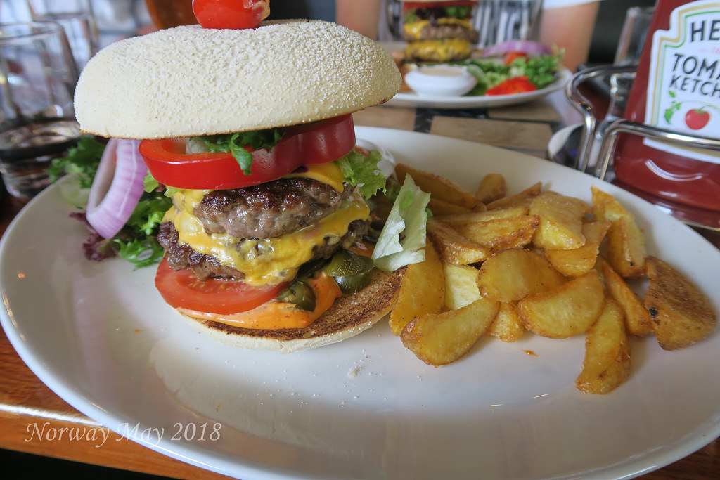
Lunch was at Inside Voss, they had all different kinds of burgers. As usual $25 USD a burger. In the afternoon we attempted to hike Mount Hanguren. I say attempted because we did not notice the sign saying the trail was closed. We made it about 3/4 of the way before we reach the barricades. All in all, a good hike, with great views. Since we had a late lunch, we decided on just snacks for dinner, before calling it a day.
Day 7 Voss to Bergen
Bergen, historically Bjørgvin, is a city and municipality in Hordaland on the west coast of Norway. At the end of the first quarter of 2016, the municipality's population was 278,121, and the Bergen metropolitan region has about 420,000 inhabitants. Bergen is the second-largest city in Norway. The municipality covers 465 square kilometers (180 sq mi) and is on the peninsula of Bergenshalvøyen. The city centre and northern neighborhoods are on Byfjorden, 'the city fjord', and the city is surrounded by mountains; Bergen is known as the 'city of seven mountains'. Many of the extra-municipal suburbs are on islands. Bergen is the administrative centre of Hordaland, and consists of eight boroughs - Arna, Bergenhus, Fana, Fyllingsdalen, Laksevåg, Ytrebygda, Årstad, and Åsane.
Trading in Bergen may have started as early as the 1020s. According to tradition, the city was founded in 1070 by king Olav Kyrre and was named Bjørgvin, 'the green meadow among the mountains'. It served as Norway's capital in the 13th century, and from the end of the 13th century became a bureau city of the Hanseatic League. Until 1789, Bergen enjoyed exclusive rights to mediate trade between Northern Norway and abroad and it was the largest city in Norway until the 1830s when it was surpassed by the capital, Christiania (now known as Oslo). What remains of the quays, Bryggen, is a World Heritage Site. The city was hit by numerous fires over the years. The Bergen School of Meteorology was developed at the Geophysical Institute beginning in 1917, the Norwegian School of Economics was founded in 1936, and the University of Bergen in 1946. From 1831 to 1972, Bergen was its own county. In 1972 the municipality absorbed four surrounding municipalities and became a part of Hordaland county.
The city is an international centre for aquaculture, shipping, offshore petroleum industry and subsea technology, and a
Bergen has a mild winter climate, though with a lot of precipitation. During December - March, the temperature difference between Bergen and Oslo can be up to 30 degrees Celsius, despite the fact that both cities are at approximately 60 degrees North. The Gulf Stream keeps the sea relatively warm, considering the latitude, and the mountains protect the city from cold winds from the north, north-east and east.
After lunch, we spent hours just walking the streets of Bergen. Bergen has a lot more character than Oslo. Many of the buildings are older and seemed more of what we expected to see of the architecture of Norway.
Day 8 - Bergen
This morning we visited the Norwegian Knitting Industry Museum, a 30-minute drive outside of Bergen. The knitting museum is a converted factory that made undergarments from cotton imported
After the museum, we had lunch back in Bergen, before hiking to the top of one of the surrounding hillside (320 Meters up). We could’ve taken the Fløibanen funicular. We decided to save the funicular for when we are old and tired. The views from the top of the hillside are breathtaking. We could also now see and understand how Bergen was built around the harbor.
It has been a long day so we just vegged out at the apartment, before going to sleep.
Day 9 - Bergen to Stavanger
Stavanger is a city and municipality in Norway. The city is the third-largest urban zone and metropolitan area in Norway (through conurbation with neighboring Sandnes) and the administrative centre of Rogaland county. The municipality is the fourth most populous in Norway. Located on the Stavanger Peninsula in Southwest Norway, Stavanger counts its official founding year as 1125, the year the Stavanger Cathedral was completed. Stavangers core is to a large degree 18th- and 19th-century wooden houses that are protected and considered part of the city's cultural heritage. This has caused the town centre and inner city to retain a small-town character with an unusually high ratio of detached houses, and has contributed significantly to spreading the city's population growth to outlying parts of Greater Stavanger.
The city's rapid population growth in the late 20th century was primarily a result of Norway's booming offshore oil industry. Today the oil industry is a key industry in the Stavanger region and the city is widely referred to as the Oil Capital of Norway. The largest company in the Nordic region, Norwegian energy company Statoil is headquartered in Stavanger. Multiple educational institutions for higher education are located in Stavanger. The largest of these is the University of Stavanger.
Domestic and international military installations are located in Stavanger, among these is the North Atlantic Treaty Organization's Joint Warfare Center. Other international establishments, and especially local branches of foreign oil and gas companies, contribute further to a significant foreign population in the city. Immigrants make up 11.3% of Stavanger's population. Stavanger has since the early 2000s consistently had an unemployment rate significantly lower than the Norwegian and European average. In 2011, the unemployment rate was less than 2%. The city is also among those that frequent various lists of expensive cities in the world, and Stavanger has even been ranked as the world's most expensive city by certain indexes.
Stavanger is served by international airport Stavanger Airport, Sola, which offers flights to cities in most major European countries, as well as a limited number of intercontinental charter flights. The airport was named most punctual European regional airport by flightstats.com in 2010.
Every two years, Stavanger organizes the Offshore Northern Seas (ONS), which is the second largest exhibition and conference for the energy sector. Gladmat food festival is also held each year and is considered to be one of Scandinavia's leading food festivals. The city is also known for being one of the nation's premier culinary clusters. Stavanger 2008 European Capital of Culture.
The drive from Bergen to Stavanger is along the west coast of Norway, heading due South. The 5-hour drive includes two ferry crossings 40 minutes each. The terrain changed as we continued south, grass fields with large granite boulders. It was like the ice glaciers just drop boulders where ever they felt on the way to the sea. Dotting the fields with these large boulders.
Stavanger was larger than we expected. The third largest metropolitan area in Norway. We arrived about 3 PM, got situated and then headed out to find our meeting place. The main reason we are in Stavanger is to hike Kjerag. We hired a guide and are to meet them the next morning at 4:55 AM at the Tourist Information Center.
We found our meeting spot and then headed to Sabi Sushi to get a late lunch early dinner. Sabi Sushi is known throughout Europe as the go-to place for the best sushi. We each ordered the chefs choice. We each got something different and no one was disappointed.
It was now time to prepare for the next day's hike and get to bed early, as we had a 4 AM wake up call.
Day 10 - Hiking Kjerag
This time a year Norway could still have snow. For this reason, we booked a guide, just in case Outdoor Life Norway. We met our guide Otto at the Stavanger Tourist Center at 4:55 AM. Along with Otto, his assistant guide Pedro will be joining us. After we left the tourist center we picked up a French family of four, and two ladies from Vienna. The 10 of us will be hiking together.
The trailhead for Kjerag is either a drive and ferry or just the drive. Either way, it is about two hours to get to the trailhead. For our hike, we will do the drive/ferry to get to the trailhead and do the drive to get back to Stavanger.
The ferry was smaller than the two ferries we had been on the day before. This ferry only carried a few cars compared to the day before where the ferries could carry hundreds of cars. The ferry ride was through a narrow fjord, with granite walls thousands of feet straight up.
The main purpose of hiking Kjerag is to reach the suspended Boulder. The forming of this natural structure is a testament to the power of the ice glacier. In this case, as the glacier moved, it carves a crevice while at the same time carrying this huge boulder. When the ice melted it dropped the boulder into the crevice.
Once we reached the boulder Otto gave us instructions on how to get out onto the rock. He said the most important instruction was, whatever you do, "DO NOT LOOK DOWN!" the drop is over 800 meters. Margarite and I volunteered to take pictures as each person took their turn going out onto the boulder.
The hike back was just as beautiful, with magnificent views of the fjord. The road that we took back to Stavanger has an interesting story. The town that the ferry drop this off at, Lysebotn has about eight full-time residence but supplies all the electrical power to the city of Stavanger. There are glacier lakes far above the town of Lysebotn. The Norwegians cut tunnels under these lakes creating powerful waterfalls. They then installed turbines inside these tunnels. The turbines turn generators creating electrical power.
In order to get this power to Stavanger power lines needed to be run. To run the power lines a road needed to be built. That is the story behind the road we were now driving on.
Video - Hiking Kjerag
It has been a long day the Tourist Center where we parked is right at the harbor which has many shops and restaurants. We decided to enjoy the beautiful weather and have a drink and some dinner at a restaurant named Mexico. I know we have now had Mexican, Hamburgers, Sushi, and now Mexican again. What about Norwegian food. That is a whole other story. The food and margaritas were nice. The negative was we had to move inside because of all the smokers. This was not unique to Mexico or Stavanger. We have noticed throughout the trip. My guess 90% of Norwegian smoke. This is across the board for all ages all sexes.
All in all, we had a great day. A long day, it was close to 8 PM by the time we got back to the house.
Day 11 - Stavanger to Odda
Odda is a municipality in Hordaland county, Norway. The municipality is located in southeastern Hordaland county, surrounding the southern end of the Sørfjorden. The administrative centre is the town of Odda, which is also the main commercial and economic centre of the entire Hardanger region. Other villages in the municipality include Botnen, Eitrheim, Håra, Røldal, Seljestad, Skare, and Tyssedal.
The 1,616-square-kilometre (624 sq mi) municipality is the 42nd largest by area out of the 422 municipalities in Norway. Odda is the 150th most populous municipality in Norway with a population of 7,025. The municipality's population density is 4.8 inhabitants per square kilometre (12/sq mi) and its population has decreased by 1.8% over the last decade.
In 1927, Erling Johnson, working at Odda Smelteverk, invented a process to produce three component, NPK fertilizers. This process is now known as the Odda process.
Today we will be driving to Odda from Stavanger. Before heading to Odda, Margarite and I got up early, 5:00 AM to walk the town and take pictures. With the sun rising and setting so early and late it is tough to take pictures without getting shadows. Stavanger has some cool murals and parks and we wanted to get some photographs before the sun was high in the sky.
After the photo session and some breakfast, we got on the road. First, we backtracked towards Bergen taking the second ferry we had taken just two days before. At some point, after exiting the ferry we turn northeast until we reach Odda a small town sitting on the edge of a fjord. Before arriving at Odda, we pass by several large waterfalls. We stopped at a couple to take pictures and get a break from the drive.
Margarite had found an industrial museum we could visit named Norwegian Museum of Hydropower and Industry. We visited the museum before checking in and getting ready for the next days' hike. The museum had to do with the history of Odda and the coming of the power plant. Odda had been a poor farming community until some foreigners bought the local waterfall at first to make it a tourist destination and then to build an electrical generating plant. This brought cheap electricity to the area which brought manufacturing, which helped grow the town of Odda.
After checking into our apartment and doing some grocery shopping we headed to the Trolltunga Hotel. We had a 9:00 PM orientation meeting for our next days' hike. We had hired a guide from a company called Trolltunga Active (http://trolltunga-active.com/activities/hiking-and-biking/). BIG MISTAKE. The orientation meeting gave us an overview of what we needed and what to expect. We needed to depart the next morning at 7 AM. We departed the hotel back to our apartment to hit the hay.
Day 12 - Trolltunga Hike
Trolltunga (Troll tongue) is a rock formation situated about 1,100 metres above sea level in the municipality of Odda in Hordaland county, Norway. The special cliff is jutting horizontally out from the mountain, into free air about 700 metres (2,300 ft) above the north side of the lake Ringedalsvatnet.
Popularity of the hike to Trolltunga and rock formation itself has exploded in recent years. The increased popularity has turned Trolltunga into a national icon and a major tourist attraction for the region. Until 2010, less than 800 people hiked to Trolltunga each year. In 2016 more than 80,000 people hiked the 27 kilometres round-trip from Skjeggedal, making it one of Norway's most popular hikes.
We met at Trolltunga Active just before 7:30 AM, which was the scheduled departing time. Trolltunga Active is in Skjeggedal. We were told because of the chaos we would be delayed. We did not the depart until 8:30 AM.
After just 10 minutes we stopped for a break, we stopped on a small landing only a few people could fit. The rest of the hikers had to stand on small granite steps. Then I realize why we stopped two more hikers showed up. They had shown up late so we had to wait. With 24 hikers, unless you are one of the first few the only scenery you see is the backs, buttocks, and legs of other hikers. After about an hour of this and several breaks, we had enough. We told the guide we would go ahead on our own. A total waste of 1100 Norwegian Kroner. BIG MISTAKE hiring Trolltunga Active.
The hike was 28 km 17 miles, with 3000 feet of elevation change. It was a challenging hike, but just as beautiful as the other hikes in Norway great views of the granite walls of the fjords. We crossed many streams created by melting snow. We also crossed many snowfields. One nice thing when hiking in Norway all the water from the streams is drinkable. This allows you to carry less water which means last weight. The hike is out and back at the turnaround point which is the sheer drop. A rock protrudes out of the cliff side creating what looks like a dive platform. The name Trolltunga comes from people saying the platform is a trolls tongue. Each hiker takes a turn and goes on to the platform to have their picture taken.
The line when we arrive was about 25 hikers long. "Z" and Dan the Man Jr. waited as we took their pictures. When we left it was 2 PM. Our original group of hikers was just arriving a full hour after us. The hike back was tough we were all tired, it had been a long day. We are very happy we left our group. Who knows what time they finish the hike.
NEVER USE TROLLTUNGA ACTIVE
We washed up and hit the hay it had been a long day.
Day 13 - Oda to Drammen
This will be our last full day in Norway we have over a 5-hour drive to get close to Oslo for our next
A quiet little town on the river. We walked a bit before finding a nice little place for drinks and dinner on the river. It took hard work to get a table that was outside and still not surrounded by smokers, Margarite found one.
Day 14 - Time to go home.
Our flight is not until 2:45 PM. With the extra time, we decided to go to the Munch Museum in Oslo. It was well worth the stop. The art was interesting and the setup/flow of the museum was well thought out.
That’s it from Norway.
Cheers,
DUG
All Pictures